|
search place name
|
||
El Encinal Verde (México, Mexico)El Encinal Verde is a town in the México region of Mexico. An overview map of the region around El Encinal Verde is displayed below.
regional and 3d topo map of El Encinal Verde, Mexico ::

El Encinal Verde airports ::
The nearest airport is TLC - Toluca Licenciado Adolfo Lopez Mateos Intl, located 91.6 km north east of El Encinal Verde.
Other airports nearby include CVJ - Cuernavaca General Mariano Matamoros (98.4 km east), MEX - Mexico City Licenciado Benito Juarez Intl (139.4 km north east), MLM - Morelia General Francisco J Mujica Intl (148.9 km north west), ZIH - Ixtapa Zihuatanejo Intl (185.8 km south west), Nearby towns ::
Corral de Piedra (1.6km north west) //
El Puente Viejo (2.9km north east) //
El Monteal (3.5km east) //
Tlacotepec (3.5km west) //
Los Planes (3.7km north west) //
Los Encinos (3.8km east) //
Chapuluapan (4.4km west) //
Atenco (4.4km east) //
Las Joyas (4.4km east) //
Los Huajes (4.9km south west) //
La Parota de Tepehuajes (5.5km south east) //
San Miguel (5.7km south east) //
San Felipe de Jesús (5.7km north east) //
Las Parotas (6.1km north) //
La Guitarra (6.1km north) //
La Cofradía (6.1km north) //
Los Cuahoilotes (6.2km south west) //
Tirados (6.1km north west) //
El Salitre (6.0km west) //
Llamas (6.2km north east) //
San Martín (6.3km west) //
El Veladero (6.6km south east) //
Monte de Dios (7.0km north west) //
Cerro Alto (7.3km north west) //
Ixtapan (7.4km north east) //
Tepehuastitlán (7.4km west) //
El Corupo (7.7km north east) //
Malpaso (7.7km north west) //
Cerro de Las Ánimas (7.9km west) //
[all distances 'as the bird flies' and approximate] 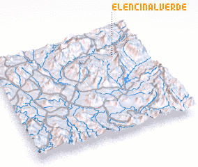 Places with similar names to El Encinal Verde, Mexico :: Disclaimer :: Information on this page comes without warranty of any kind |
||
|
Where is El Encinal Verde? Elevation and coordinates ::
Latitude (lat): 18°45'45"N Longitude (lon): 100°11'30"W
Elevation (approx.): 1343m (map arrows pan, magnifying glasses zoom) |
||
|
Visiting El Encinal Verde? Hotel/Accommodation ::
Book a hotel in El Encinal Verde Travel Guide ::
Buy a travel guide for Mexico rental cars ::
car rental offers GPS waypoint ::
download a GPX waypoint (PoI) of El Encinal Verde for your GPS receiver
|
||