|
search place name
|
||
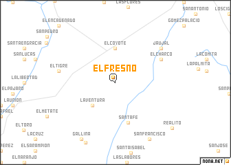
El Fresno (Nuevo León, Mexico)El Fresno is a town in the Nuevo León region of Mexico. An overview map of the region around El Fresno is displayed below.
regional and 3d topo map of El Fresno, Mexico ::
El Fresno airports ::
The nearest airport is MTY - Monterrey General Mariano Escobedo Intl, located 81.6 km north west of El Fresno.
Other airports nearby include NTR - Monterrey Del Norte Intl (97.8 km north west), REX - Reynosa General Lucio Blanco Intl (140.3 km north east), MFE - Mcallen Mc Allen Miller Intl (149.7 km north east), SLW - Saltillo Plan De Guadalupe Intl (151.7 km west), Nearby towns ::
La Ventura (5.0km south west) //
El Coyote (5.6km north) //
Santa Fe (6.8km south) //
El Charco (7.7km north east) //
Jaujal (8.7km north east) //
[all distances 'as the bird flies' and approximate] 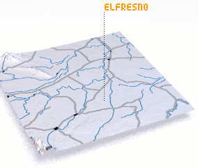 Places with similar names to El Fresno, Mexico ::
Disclaimer :: Information on this page comes without warranty of any kind |
||
|
Where is El Fresno? Elevation and coordinates ::
Latitude (lat): 25°22'0"N Longitude (lon): 99°26'0"W
Elevation (approx.): 222m (map arrows pan, magnifying glasses zoom) |
||
|
Visiting El Fresno? Hotel/Accommodation ::
Book a hotel in El Fresno Travel Guide ::
Buy a travel guide for Mexico rental cars ::
car rental offers GPS waypoint ::
download a GPX waypoint (PoI) of El Fresno for your GPS receiver
|
||