|
search place name
|
||
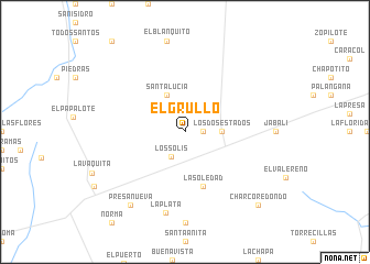
El Grullo (Nuevo León, Mexico)El Grullo is a town in the Nuevo León region of Mexico. An overview map of the region around El Grullo is displayed below.
regional and 3d topo map of El Grullo, Mexico ::
El Grullo airports ::
The nearest airport is REX - Reynosa General Lucio Blanco Intl, located 39.0 km east of El Grullo.
Other airports nearby include MFE - Mcallen Mc Allen Miller Intl (43.4 km north east), HRL - Harlingen Valley Intl (100.0 km east), MAM - Matamoros General Servando Canales Intl (111.9 km east), BRO - Brownsville South Padre Island Intl (119.6 km east), Nearby towns ::
Santa Fe (1.7km east) //
Los Solis (2.9km south west) //
Los Dos Estados (3.3km east) //
Santa Lucía (4.1km north west) //
La Soledad (5.8km south) //
La Plata (8.4km south) //
Presa Nueva (8.9km south west) //
Charco Redondo (10.0km south east) //
[all distances 'as the bird flies' and approximate] 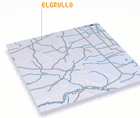 Places with similar names to El Grullo, Mexico ::
// El Criollo (PA)
// El Grillo (PA)
// El Carril (CU)
// El Carril (CU)
// El Carril (CU)
// El Coral (CU)
// El Corral (CU)
// El Criollo (CU)
// El Grillo (CU)
// El Carril (ES)
Disclaimer :: Information on this page comes without warranty of any kind |
||
|
Where is El Grullo? Elevation and coordinates ::
Latitude (lat): 25°59'0"N Longitude (lon): 98°37'0"W
Elevation (approx.): 84m (map arrows pan, magnifying glasses zoom) |
||
|
Visiting El Grullo? Hotel/Accommodation ::
Book a hotel in El Grullo Travel Guide ::
Buy a travel guide for Mexico rental cars ::
car rental offers GPS waypoint ::
download a GPX waypoint (PoI) of El Grullo for your GPS receiver
|
||