|
search place name
|
||
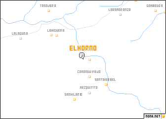
El Horno (Baja California Sur, Mexico)El Horno is a town in the Baja California Sur region of Mexico. An overview map of the region around El Horno is displayed below.
regional and 3d topo map of El Horno, Mexico ::
El Horno airports ::
The nearest airport is LTO - Loreto Intl, located 52.8 km south east of El Horno.
Other airports nearby include GYM - Guaymas General Jose Maria Yanez Intl (204.3 km north east), CEN - Ciudad Obregon Intl (227.8 km north east), Nearby towns ::
San Juan (1.3km east) //
Comondú Viejo (4.0km south) //
Mezquitito (7.6km south) //
Santa Isabel (7.3km south east) //
La Higuera (7.6km north west) //
Calaqua (8.5km north west) //
[all distances 'as the bird flies' and approximate] 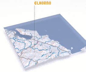 Places with similar names to El Horno, Mexico ::
Disclaimer :: Information on this page comes without warranty of any kind |
||
|
Where is El Horno? Elevation and coordinates ::
Latitude (lat): 26°17'3"N Longitude (lon): 111°45'48"W
Elevation (approx.): 324m (map arrows pan, magnifying glasses zoom) |
||
|
Visiting El Horno? Hotel/Accommodation ::
Book a hotel in El Horno Travel Guide ::
Buy a travel guide for Mexico rental cars ::
car rental offers GPS waypoint ::
download a GPX waypoint (PoI) of El Horno for your GPS receiver
|
||