|
search place name
|
||
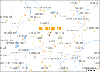
El Mezquite (Guanajuato, Mexico)El Mezquite is a town in the Guanajuato region of Mexico. An overview map of the region around El Mezquite is displayed below.
regional and 3d topo map of El Mezquite, Mexico ::
El Mezquite airports ::
The nearest airport is QRO - Queretaro Intercontinental, located 71.0 km east of El Mezquite.
Other airports nearby include BJX - Del Bajio Guanajuato Intl (75.3 km north west), MLM - Morelia General Francisco J Mujica Intl (88.3 km south), ZMM - Zamora (160.9 km south west), SLP - San Luis Potosi Ponciano Arriaga Intl (179.6 km north), Nearby towns ::
Santa Teresa (1.5km north) //
San José de la Cruz (2.8km west) //
Gasca (3.3km south) //
La Cuadrilla de Centeno (3.4km north west) //
San Román (3.5km south west) //
San Elías (3.5km east) //
El Sauz (3.9km south west) //
Pozos (3.9km south west) //
Aguirre (4.1km south east) //
Delgado (4.1km north west) //
Pozos (4.4km south east) //
San José de Manantiales (4.9km south west) //
Los Llanos (5.2km west) //
Yustis (5.6km south) //
Elguera (5.8km south) //
San Antonio de Morales (6.1km south west) //
San Cayetano (6.3km south east) //
Franco Tavera (6.8km south west) //
Neutla (7.6km north) //
Don Diego (7.9km north west) //
Plancarte (7.9km south east) //
Silva (8.3km south east) //
Rosillo (8.2km north west) //
Presa Blanca (8.2km east) //
San José de Guanajuato (8.7km south) //
Santa Rosa (9.1km south west) //
Roque (9.1km south east) //
La Cantera (9.1km north east) //
El Agostadero (9.5km north west) //
[all distances 'as the bird flies' and approximate] 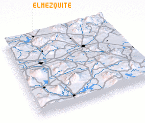 Places with similar names to El Mezquite, Mexico ::
// El Mosquito (CO)
// El Mosquito (GT)
// El Mezquite (MX)
// El Mezquite (MX)
// El Mezquite (MX)
// El Mezquite (MX)
// El Mezquite (MX)
// El Mezquite (MX)
// El Mezquite (MX)
// El Mezquite (MX)
Disclaimer :: Information on this page comes without warranty of any kind |
||
|
Where is El Mezquite? Elevation and coordinates ::
Latitude (lat): 20°38'0"N Longitude (lon): 100°52'0"W
Elevation (approx.): 1782m (map arrows pan, magnifying glasses zoom) |
||
|
Visiting El Mezquite? Hotel/Accommodation ::
Book a hotel in El Mezquite Travel Guide ::
Buy a travel guide for Mexico rental cars ::
car rental offers GPS waypoint ::
download a GPX waypoint (PoI) of El Mezquite for your GPS receiver
|
||