|
search place name
|
||
El Rucio (Nuevo León, Mexico)El Rucio is a town in the Nuevo León region of Mexico. An overview map of the region around El Rucio is displayed below.
regional and 3d topo map of El Rucio, Mexico ::

El Rucio airports ::
The nearest airport is CVM - Ciudad Victoria General Pedro Jose Mendez Intl, located 166.6 km east of El Rucio.
Other airports nearby include SLW - Saltillo Plan De Guadalupe Intl (179.1 km north), SLP - San Luis Potosi Ponciano Arriaga Intl (193.3 km south), MTY - Monterrey General Mariano Escobedo Intl (206.0 km north), NTR - Monterrey Del Norte Intl (213.0 km north), Nearby towns ::
Santa Isabel (3.1km south east) //
Zamarripa (5.4km west) //
La Joya (7.6km north) //
San Antonio del Sotol (7.7km north west) //
Tanque Nuevo (8.2km south west) //
La Pinta (9.0km south west) //
La Presita de Maclas (9.5km south) //
El Barrio (10.0km south west) //
[all distances 'as the bird flies' and approximate] 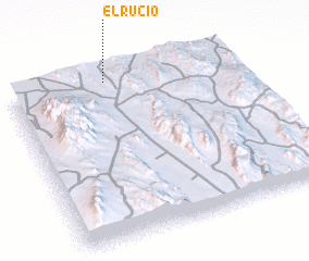 Places with similar names to El Rucio, Mexico ::
// El Aroussa (MA)
// El Aroussi (MA)
// El Arsa (MA)
// El Roso (PA)
// El Arce (CU)
// El Iris (CU)
// El Aroussia (TN)
// Elorz (ES)
// El Raso (ES)
// El Rocío (ES)
Disclaimer :: Information on this page comes without warranty of any kind |
||
|
Where is El Rucio? Elevation and coordinates ::
Latitude (lat): 23°58'0"N Longitude (lon): 100°34'0"W
Elevation (approx.): 1793m (map arrows pan, magnifying glasses zoom) |
||
|
Visiting El Rucio? Hotel/Accommodation ::
Book a hotel in El Rucio Travel Guide ::
Buy a travel guide for Mexico rental cars ::
car rental offers GPS waypoint ::
download a GPX waypoint (PoI) of El Rucio for your GPS receiver
|
||