|
search place name
|
||
El Saltillo (México, Mexico)El Saltillo is a town in the México region of Mexico. An overview map of the region around El Saltillo is displayed below.
regional and 3d topo map of El Saltillo, Mexico ::

El Saltillo airports ::
The nearest airport is TLC - Toluca Licenciado Adolfo Lopez Mateos Intl, located 77.1 km south of El Saltillo.
Other airports nearby include QRO - Queretaro Intercontinental (84.0 km north west), MEX - Mexico City Licenciado Benito Juarez Intl (91.4 km south east), PCA - Pachuca Ingeniero Juan Guillermo Villasana (94.4 km east), CVJ - Cuernavaca General Mariano Matamoros (139.0 km south), Nearby towns ::
Aldama (0.9km north) //
El Azafrán (2.8km north) //
Aldama (2.9km south) //
Los Pilares (4.5km west) //
Huapango (5.3km south) //
La Palma (5.4km west) //
Majuay (5.8km north) //
San Martín (5.8km north) //
Llano Grande (6.0km south east) //
Las Arenas (6.4km south west) //
Llano Grande (6.4km south east) //
La Estancia (6.7km north) //
Calpulalpan (7.4km north east) //
Llano Grande (7.5km east) //
El Rosal (8.3km north) //
Las Jaras (8.3km south east) //
Bonxhi (8.2km north west) //
San Martín (9.8km north east) //
Canalejas (9.7km south east) //
[all distances 'as the bird flies' and approximate] 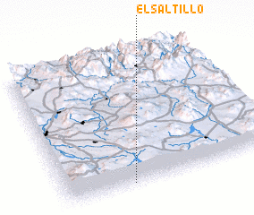 Places with similar names to El Saltillo, Mexico ::
// El Saltillo (CL)
// El Salitillo (MX)
// El Saltillo (MX)
// El Saladillo (VE)
// El Saladillo (VE)
// El Saladillo (VE)
// El Saladillo (VE)
// El Saladillo (CL)
// El Saladillo (DO)
// El Saladillo (AR)
Disclaimer :: Information on this page comes without warranty of any kind |
||
|
Where is El Saltillo? Elevation and coordinates ::
Latitude (lat): 20°1'30"N Longitude (lon): 99°41'0"W
Elevation (approx.): 2678m (map arrows pan, magnifying glasses zoom) |
||
|
Visiting El Saltillo? Hotel/Accommodation ::
Book a hotel in El Saltillo Travel Guide ::
Buy a travel guide for Mexico rental cars ::
car rental offers GPS waypoint ::
download a GPX waypoint (PoI) of El Saltillo for your GPS receiver
|
||