|
search place name
|
||
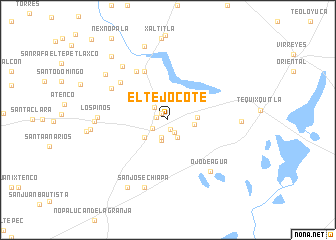
El Tejocote (Tlaxcala, Mexico)El Tejocote is a town in the Tlaxcala region of Mexico. An overview map of the region around El Tejocote is displayed below.
regional and 3d topo map of El Tejocote, Mexico ::
El Tejocote airports ::
The nearest airport is TXA - Tlaxcala, located 51.3 km north west of El Tejocote.
Other airports nearby include PBC - Puebla Hermanos Serdan Intl (68.4 km west), TCN - Tehuacan (97.0 km south), PCA - Pachuca Ingeniero Juan Guillermo Villasana (137.6 km north west), MEX - Mexico City Licenciado Benito Juarez Intl (140.2 km west), Nearby towns ::
Manuel Ávila Camacho (1.1km north west) //
Colonia del Valle (1.1km south) //
San Juan Mazarraza (1.2km west) //
San Diego Cuexcontzl (1.6km south east) //
Santa Rebeca (1.9km south west) //
Loma Bonita (2.0km north west) //
San Lorenzo (2.1km south) //
San Diego Cuexcontzl (2.3km south east) //
San Isidro Ovando (2.4km south) //
Plan de Ayala (2.8km east) //
San Francisco Cuexcontl (3.1km east) //
Cuapiaxtla (3.2km south west) //
Santa María Zoapila (5.9km north west) //
Las Delicias (6.4km north west) //
Igancio Allende (6.5km north west) //
San Miguel Franco (7.0km north west) //
Ojo de Agua (7.3km south east) //
Los Pinos (7.4km west) //
Santa Martha (7.7km north west) //
San José Chiapa (8.0km south) //
La Roscorita (7.7km west) //
Guadalupe (7.7km east) //
Pocitos (8.6km north) //
Margarita (8.3km north west) //
José María Morelos (8.2km west) //
Rafael Lara Grajales (8.7km south west) //
El Mirador (9.3km north west) //
[all distances 'as the bird flies' and approximate]  Places with similar names to El Tejocote, Mexico ::
// El Tejocote (MX)
// El Tejocote (MX)
// El Tejocote (MX)
// El Tejocote (MX)
// El Tejocote (MX)
// El Tejocote (MX)
// El Tejocote (MX)
// El Tejocote (MX)
// El Tejocote (MX)
// El Tejocote (MX)
Disclaimer :: Information on this page comes without warranty of any kind |
||
|
Where is El Tejocote? Elevation and coordinates ::
Latitude (lat): 19°19'5"N Longitude (lon): 97°44'35"W
Elevation (approx.): 2456m (map arrows pan, magnifying glasses zoom) |
||
|
Visiting El Tejocote? Hotel/Accommodation ::
Book a hotel in El Tejocote Travel Guide ::
Buy a travel guide for Mexico rental cars ::
car rental offers GPS waypoint ::
download a GPX waypoint (PoI) of El Tejocote for your GPS receiver
|
||