|
search place name
|
||
El Zapotal (Hidalgo, Mexico)El Zapotal is a town in the Hidalgo region of Mexico. An overview map of the region around El Zapotal is displayed below.
regional and 3d topo map of El Zapotal, Mexico ::

El Zapotal airports ::
The nearest airport is TSL - Tamuin, located 83.5 km north of El Zapotal.
Other airports nearby include PCA - Pachuca Ingeniero Juan Guillermo Villasana (136.3 km south), QRO - Queretaro Intercontinental (148.2 km south west), TAM - Tampico General Francisco Javier Mina Intl (158.1 km north east), PAZ - Poza Rico Tajin (173.7 km south east), Nearby towns ::
Arroyo Seco (0.9km east) //
Las Moras (1.4km south east) //
Puerto Obscuro (1.6km south west) //
Agua Buena (2.3km north) //
El Amolar (2.5km south) //
La Laguna (2.8km west) //
Agua Zarca (3.0km south east) //
Xilitla (4.1km north) //
Tenepango (4.1km north) //
Chalahuitito (4.3km south east) //
Linderos (4.6km east) //
San José Casas Viejas (5.1km south west) //
Arena (5.3km south) //
La Tinaja (5.3km south) //
Pilahuehueyo (5.9km north east) //
Ameca (6.2km south east) //
Cerro Grande (6.5km south) //
Sabino (6.4km north west) //
Ahuehueyo Grande (6.4km north east) //
Chalahuite (6.5km south) //
San Francisco (6.2km east) //
La Meca (6.8km south east) //
El Bonigu (7.0km south west) //
El Carrizal (6.9km south east) //
Guayabos (7.5km west) //
El Caracol (8.3km south) //
Escondida de San Rafael (8.0km south west) //
Victoria (8.1km west) //
Tlaxco (8.1km east) //
[all distances 'as the bird flies' and approximate] 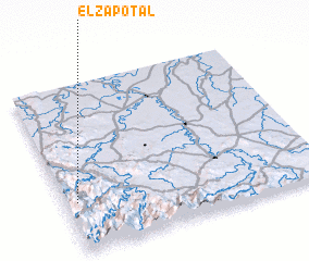 Places with similar names to El Zapotal, Mexico ::
// El Zapotal (PA)
// El Zapotal (CR)
// El Zapotal (SV)
// El Zapotal (SV)
// El Zapotal (SV)
// El Zapotal (SV)
// El Zapotal (SV)
// El Zapotillo (SV)
// El Zapotal (GT)
// El Zapotal (GT)
Disclaimer :: Information on this page comes without warranty of any kind |
||
|
Where is El Zapotal? Elevation and coordinates ::
Latitude (lat): 21°17'50"N Longitude (lon): 98°57'30"W
Elevation (approx.): 521m (map arrows pan, magnifying glasses zoom) |
||
|
Visiting El Zapotal? Hotel/Accommodation ::
Book a hotel in El Zapotal Travel Guide ::
Buy a travel guide for Mexico rental cars ::
car rental offers GPS waypoint ::
download a GPX waypoint (PoI) of El Zapotal for your GPS receiver
|
||