|
search place name
|
||
Empanada (San Luis Potosí, Mexico)Empanada is a town in the San Luis Potosí region of Mexico. An overview map of the region around Empanada is displayed below.
regional and 3d topo map of Empanada, Mexico ::

Empanada airports ::
The nearest airport is SLP - San Luis Potosi Ponciano Arriaga Intl, located 98.6 km north west of Empanada.
Other airports nearby include QRO - Queretaro Intercontinental (119.9 km south), TSL - Tamuin (147.2 km east), BJX - Del Bajio Guanajuato Intl (155.7 km south west), MLM - Morelia General Francisco J Mujica Intl (222.8 km south west), Nearby towns ::
Sotolar (0.0km north) //
Las Adjuntas (1.7km east) //
Las Enramadas (4.1km north west) //
San Isidro de Bagres (4.1km north west) //
Soyatito (6.4km north west) //
Nopalitos (6.9km west) //
Chapala (7.4km north) //
Malpaso (7.1km east) //
El Campanario (7.1km east) //
Yerbabuena (7.1km east) //
Las Huertitas (7.6km north) //
Zapotito (7.6km north) //
La Parada (7.8km south east) //
Río Verde (8.6km south) //
Mangas (8.9km south east) //
Galemes (10.1km north east) //
Esta (11.2km south west) //
[all distances 'as the bird flies' and approximate] 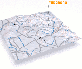
Disclaimer :: Information on this page comes without warranty of any kind |
||
|
Where is Empanada? Elevation and coordinates ::
Latitude (lat): 21°42'0"N Longitude (lon): 100°11'0"W
Elevation (approx.): 1355m (map arrows pan, magnifying glasses zoom) |
||
|
Visiting Empanada? Hotel/Accommodation ::
Book a hotel in Empanada Travel Guide ::
Buy a travel guide for Mexico rental cars ::
car rental offers GPS waypoint ::
download a GPX waypoint (PoI) of Empanada for your GPS receiver
|
||