|
search place name
|
||
Encinal (Oaxaca, Mexico)Encinal is a town in the Oaxaca region of Mexico. An overview map of the region around Encinal is displayed below.
regional and 3d topo map of Encinal, Mexico ::

Encinal airports ::
The nearest airport is HUX - Bahias Dehuatulco Bahias De Huatulco Intl, located 89.1 km south west of Encinal.
Other airports nearby include OAX - Oaxaca Xoxocotlan Intl (151.1 km north west), PXM - Puerto Escondido Intl (167.2 km west), MTT - Minatitlan (233.7 km north east), Nearby towns ::
El Llano (2.6km north west) //
El Mango (4.1km south east) //
Huanacaxtle (5.8km south) //
San Juan Zaragoza (6.0km south) //
San Miguel Tenango (6.6km north west) //
Potrero Adentro (7.1km east) //
Calzada (7.6km south) //
Coyul (7.7km north east) //
Huanacaxtle (7.7km south west) //
El Guiligui (7.7km south east) //
Loma Atravesada (7.9km south east) //
El Ciprés (8.9km south west) //
Santa Catarina (9.1km north west) //
Tenería (10.3km south east) //
Concepción (11.3km north east) //
[all distances 'as the bird flies' and approximate] 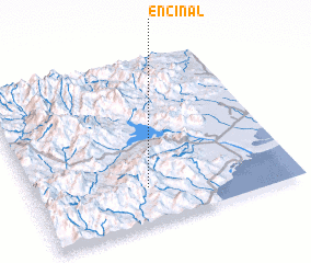 Places with similar names to Encinal, Mexico ::
Disclaimer :: Information on this page comes without warranty of any kind |
||
|
Where is Encinal? Elevation and coordinates ::
Latitude (lat): 16°13'0"N Longitude (lon): 95°34'0"W
Elevation (approx.): 857m (map arrows pan, magnifying glasses zoom) |
||
|
Visiting Encinal? Hotel/Accommodation ::
Book a hotel in Encinal Travel Guide ::
Buy a travel guide for Mexico rental cars ::
car rental offers GPS waypoint ::
download a GPX waypoint (PoI) of Encinal for your GPS receiver
|
||