|
search place name
|
||
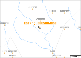
Estanque de San José (Coahuila de Zaragoza, Mexico)Estanque de San José is a town in the Coahuila de Zaragoza region of Mexico. An overview map of the region around Estanque de San José is displayed below.
regional and 3d topo map of Estanque de San José, Mexico ::
Estanque de San José airports ::
The nearest airport is PDS - Piedras Negras Intl, located 86.4 km north east of Estanque de San José.
Other airports nearby include LOV - Monclova Intl (132.9 km south), DLF - Del Rio Laughlin Afb (142.5 km north), NLD - Nuevo Laredo Quetzalcoatl Intl (179.3 km south east), LRD - Laredo Intl (184.8 km east), Nearby towns ::
La Becerra (3.7km north) //
San Isidro (8.9km north east) //
[all distances 'as the bird flies' and approximate] 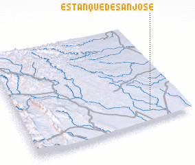 Places with similar names to Estanque de San José, Mexico :: Disclaimer :: Information on this page comes without warranty of any kind |
||
|
Where is Estanque de San José? Elevation and coordinates ::
Latitude (lat): 28°8'0"N Longitude (lon): 101°13'0"W
Elevation (approx.): 422m (map arrows pan, magnifying glasses zoom) |
||
|
Visiting Estanque de San José? Hotel/Accommodation ::
Book a hotel in Estanque de San José Travel Guide ::
Buy a travel guide for Mexico rental cars ::
car rental offers GPS waypoint ::
download a GPX waypoint (PoI) of Estanque de San José for your GPS receiver
|
||