|
search place name
|
||
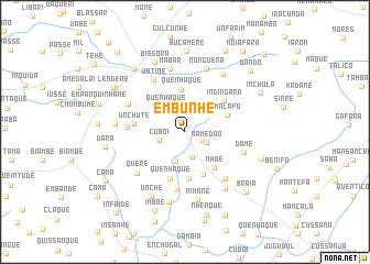
Embunhe (Oio, Guinea-Bissau)Embunhe is a town in the Oio region of Guinea-Bissau. An overview map of the region around Embunhe is displayed below.
regional and 3d topo map of Embunhe, Guinea-Bissau ::
Embunhe airports ::
The nearest airport is BXO - Bissau Oswaldo Vieira Intl, located 38.8 km south west of Embunhe.
Other airports nearby include ZIG - Ziguinchor (103.5 km north west), CSK - Cap Skiring (146.9 km west), BJL - Banjul Intl (186.9 km north west), KLC - Kaolack (230.3 km north), Nearby towns ::
Insontão (1.9km south east) //
Namedão (2.4km south east) //
Uanquelim (2.6km south) //
Cuboi (2.7km west) //
Uenquem (3.0km south) //
Quenhaque (3.1km north west) //
Quenhaque (4.3km north) //
Malafo (4.5km east) //
Inquida (4.6km south) //
Nhaé (4.6km south east) //
Claquiala (4.7km south) //
Quenhaque (5.0km south) //
Indíngarà (5.1km north east) //
Unchute (5.2km west) //
Chombé (5.8km south) //
Cate (5.7km west) //
Uatiné (6.1km north west) //
Loré (6.2km south east) //
Damé (6.2km east) //
Grancutá (6.3km north west) //
Queré (6.3km south west) //
Mábar (6.6km north) //
Bairro Balanta (6.6km north) //
Nonguena (6.7km north) //
Nimane (7.0km south) //
Mansabandim (7.0km north east) //
Infandre (7.0km south east) //
Grandumbé (7.0km west) //
Cumbule (7.3km south) //
[all distances 'as the bird flies' and approximate] 
Disclaimer :: Information on this page comes without warranty of any kind |
||
|
Where is Embunhe? Elevation and coordinates ::
Latitude (lat): 12°9'33"N Longitude (lon): 15°25'11"W
Elevation (approx.): 19m (map arrows pan, magnifying glasses zoom) |
||
|
Visiting Embunhe? Hotel/Accommodation ::
Book a hotel in Embunhe Travel Guide ::
rental cars ::
car rental offers GPS waypoint ::
download a GPX waypoint (PoI) of Embunhe for your GPS receiver
|
||