|
search place name
|
||
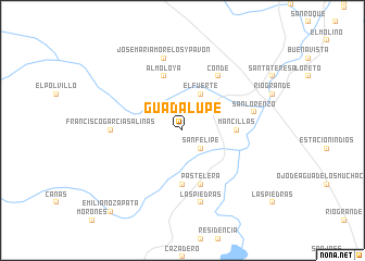
Guadalupe (Zacatecas, Mexico)Guadalupe is a town in the Zacatecas region of Mexico. An overview map of the region around Guadalupe is displayed below.
regional and 3d topo map of Guadalupe, Mexico ::
Guadalupe airports ::
The nearest airport is ZCL - Zacatecas General Leobardo C Ruiz Intl, located 109.2 km south east of Guadalupe.
Other airports nearby include DGO - Durango Intl (148.1 km west), TRC - Torreon Intl (198.1 km north), Nearby towns ::
San Felipe (2.5km south east) //
El Fuerte (4.1km north east) //
La Florida (5.1km east) //
Mancillas (5.1km east) //
Los Rodríguez (5.6km south) //
Almoloya (5.8km north) //
Pastelera (5.8km south) //
Conde (6.5km north east) //
Francisco García Salinas (6.8km west) //
Jose María Morelos y Pavón (7.6km north) //
San Lorenzo (7.0km east) //
Las Piedras (7.6km south) //
Emiliano Zapata (10.8km south west) //
[all distances 'as the bird flies' and approximate] 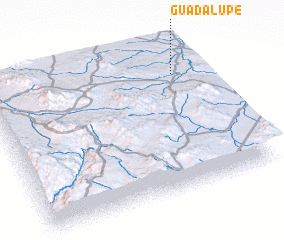 Places with similar names to Guadalupe, Mexico ::
Disclaimer :: Information on this page comes without warranty of any kind |
||
|
Where is Guadalupe? Elevation and coordinates ::
Latitude (lat): 23°48'0"N Longitude (lon): 103°7'0"W
Elevation (approx.): 1949m (map arrows pan, magnifying glasses zoom) |
||
|
Visiting Guadalupe? Hotel/Accommodation ::
Book a hotel in Guadalupe Travel Guide ::
Buy a travel guide for Mexico rental cars ::
car rental offers GPS waypoint ::
download a GPX waypoint (PoI) of Guadalupe for your GPS receiver
|
||