|
search place name
|
||
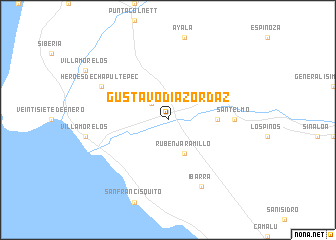
Gustavo Díaz Ordáz (Baja California, Mexico)Gustavo Díaz Ordáz is a town in the Baja California region of Mexico. An overview map of the region around Gustavo Díaz Ordáz is displayed below.
regional and 3d topo map of Gustavo Díaz Ordáz, Mexico ::
Gustavo Díaz Ordáz airports ::
The nearest airport is ESE - Ensenada, located 100.8 km north west of Gustavo Díaz Ordáz.
Other airports nearby include TIJ - Tijuana General Abelardo L Rodriguez Intl (190.4 km north west), CXL - Calexico Intl (198.7 km north), MXL - Mexicali General Rodolfo Sanchez Taboada Intl (204.2 km north east), NJK - El Centro Naf (211.8 km north), Nearby towns ::
Villa Hidalgo (2.4km north west) //
Rubén Jaramillo (4.0km south east) //
Misión de San Telmo (4.8km east) //
San Telmo (6.4km east) //
Héroes de Chapultepec (7.4km north west) //
Ibarra (8.1km south east) //
[all distances 'as the bird flies' and approximate] 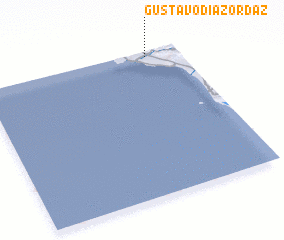 Places with similar names to Gustavo Díaz Ordáz, Mexico ::
// Gustavo Díaz Ordaz (MX)
// Gustavo Díaz Ordaz (MX)
// Gustavo Díaz Ordaz (MX)
// Gustavo Díaz Ordáz (MX)
// Gustavo Diaz Ordáz (MX)
Disclaimer :: Information on this page comes without warranty of any kind |
||
|
Where is Gustavo Díaz Ordáz? Elevation and coordinates ::
Latitude (lat): 30°58'0"N Longitude (lon): 116°10'0"W
Elevation (approx.): 45m (map arrows pan, magnifying glasses zoom) |
||
|
Visiting Gustavo Díaz Ordáz? Hotel/Accommodation ::
Book a hotel in Gustavo Díaz Ordáz Travel Guide ::
Buy a travel guide for Mexico rental cars ::
car rental offers GPS waypoint ::
download a GPX waypoint (PoI) of Gustavo Díaz Ordáz for your GPS receiver
|
||