|
search place name
|
||
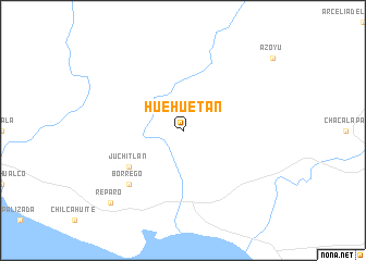
Huehuetán (Guerrero, Mexico)Huehuetán is a town in the Guerrero region of Mexico. An overview map of the region around Huehuetán is displayed below.
regional and 3d topo map of Huehuetán, Mexico ::
Huehuetán airports ::
The nearest airport is ACA - Acapulco General Juan N Alvarez Intl, located 100.7 km west of Huehuetán.
Other airports nearby include PXM - Puerto Escondido Intl (203.5 km south east), TCN - Tehuacan (252.5 km north east), Nearby towns ::
 Places with similar names to Huehuetán, Mexico ::
// Hohe Tanne (DE)
// Hahedan (ID)
// Huehuetán (MX)
// Haihetan (CN)
// Houhuodan (CN)
// Huihuidian (CN)
Disclaimer :: Information on this page comes without warranty of any kind |
||
|
Where is Huehuetán? Elevation and coordinates ::
Latitude (lat): 16°39'0"N Longitude (lon): 98°49'0"W
Elevation (approx.): 140m (map arrows pan, magnifying glasses zoom) |
||
|
Visiting Huehuetán? Hotel/Accommodation ::
Book a hotel in Huehuetán Travel Guide ::
Buy a travel guide for Mexico rental cars ::
car rental offers GPS waypoint ::
download a GPX waypoint (PoI) of Huehuetán for your GPS receiver
|
||