|
search place name
|
||
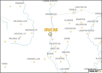
Ipucha (Sinaloa, Mexico)Ipucha is a town in the Sinaloa region of Mexico. An overview map of the region around Ipucha is displayed below.
regional and 3d topo map of Ipucha, Mexico ::
Ipucha airports ::
The nearest airport is CUL - Culiacan Intl, located 86.3 km north west of Ipucha.
Other airports nearby include MZT - Mazatlan General Rafael Buelna Intl (139.4 km south), Nearby towns ::
Papachal (1.1km south east) //
Calafato (2.4km north east) //
Calafates (4.0km south) //
Jarillas (5.8km south) //
Comoa (5.9km east) //
Vado Hondo (7.0km north) //
Buenavista (6.6km west) //
Ibonia (7.4km south) //
Los Cedros (6.8km east) //
El Limón (8.1km south east) //
El Rodeo (7.8km north east) //
Rincón de Ibonia (8.5km south) //
Guagino (8.5km south east) //
Cosalá (11.6km north east) //
[all distances 'as the bird flies' and approximate] 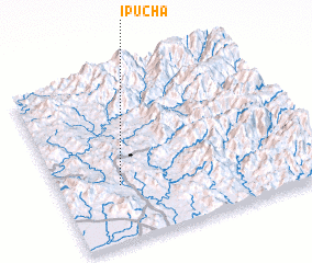 Places with similar names to Ipucha, Mexico ::
// Ipisia (PG)
Disclaimer :: Information on this page comes without warranty of any kind |
||
|
Where is Ipucha? Elevation and coordinates ::
Latitude (lat): 24°20'0"N Longitude (lon): 106°45'53"W
Elevation (approx.): 323m (map arrows pan, magnifying glasses zoom) |
||
|
Visiting Ipucha? Hotel/Accommodation ::
Book a hotel in Ipucha Travel Guide ::
Buy a travel guide for Mexico rental cars ::
car rental offers GPS waypoint ::
download a GPX waypoint (PoI) of Ipucha for your GPS receiver
|
||