|
search place name
|
||
Jaralito (San Luis Potosí, Mexico)Jaralito is a town in the San Luis Potosí region of Mexico. An overview map of the region around Jaralito is displayed below.
regional and 3d topo map of Jaralito, Mexico ::

Jaralito airports ::
The nearest airport is SLP - San Luis Potosi Ponciano Arriaga Intl, located 39.4 km north west of Jaralito.
Other airports nearby include BJX - Del Bajio Guanajuato Intl (131.2 km south west), QRO - Queretaro Intercontinental (158.1 km south), AGU - Aguascalientes Jesus Teran Intl (166.0 km west), TSL - Tamuin (199.2 km east), Nearby towns ::
Texas (1.9km south) //
El Carmen (2.5km south east) //
Parada (3.4km east) //
Enramada (4.1km south west) //
Cisco (5.1km south east) //
Alberca (5.1km north east) //
Soledad (5.6km south) //
Camarillo (5.6km south) //
Cerro Gordo (6.9km west) //
Venadito (7.1km west) //
Rancho Seco (7.6km south) //
Cruz (7.8km north east) //
La Esperanza (8.2km north west) //
El Palmarito (9.0km south east) //
Peregrina de Arriba (10.1km south east) //
Enramadas (10.1km south west) //
[all distances 'as the bird flies' and approximate] 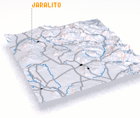 Places with similar names to Jaralito, Mexico ::
Disclaimer :: Information on this page comes without warranty of any kind |
||
|
Where is Jaralito? Elevation and coordinates ::
Latitude (lat): 21°57'0"N Longitude (lon): 100°44'0"W
Elevation (approx.): 1935m (map arrows pan, magnifying glasses zoom) |
||
|
Visiting Jaralito? Hotel/Accommodation ::
Book a hotel in Jaralito Travel Guide ::
Buy a travel guide for Mexico rental cars ::
car rental offers GPS waypoint ::
download a GPX waypoint (PoI) of Jaralito for your GPS receiver
|
||