|
search place name
|
||
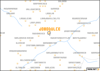
Jobo Dulce (Chiapas, Mexico)Jobo Dulce is a town in the Chiapas region of Mexico. An overview map of the region around Jobo Dulce is displayed below.
regional and 3d topo map of Jobo Dulce, Mexico ::
Jobo Dulce airports ::
The nearest airport is TGZ - Tuxtla Gutierrez Angel Albino Corzo, located 41.3 km east of Jobo Dulce.
Other airports nearby include VSA - Villahermosa C P A Carlos Rovirosa Intl (180.3 km north), TAP - Tapachula Intl (215.5 km south east), MTT - Minatitlan (220.4 km north west), Nearby towns ::
Michelin (1.9km north) //
San Sebastián (3.7km south) //
Nueva Tenochtitlán (4.1km south east) //
Nuevo México (4.1km west) //
La Majada (5.8km north) //
El Cielito (5.8km north) //
Las Flores (6.7km north west) //
Cristobal Obregón (7.0km south west) //
La Selva (7.4km north) //
Rincón (7.3km west) //
San Juan Bautista (7.6km south) //
Unión y Progreso (8.0km east) //
El Rubí (8.3km north west) //
[all distances 'as the bird flies' and approximate] 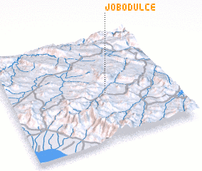 Places with similar names to Jobo Dulce, Mexico ::
// Jobo Dulce (PA)
// Jobo Dulce (PA)
// Jobo Dulce (CU)
// Jabo Dulce (DO)
// Jobo Dulce (DO)
// Jobo Dulce (DO)
// Jobo Dulce (DO)
// Jobo Dulce (DO)
// Jobo Dulce (DO)
Disclaimer :: Information on this page comes without warranty of any kind |
||
|
Where is Jobo Dulce? Elevation and coordinates ::
Latitude (lat): 16°28'0"N Longitude (lon): 93°24'0"W
Elevation (approx.): 769m (map arrows pan, magnifying glasses zoom) |
||
|
Visiting Jobo Dulce? Hotel/Accommodation ::
Book a hotel in Jobo Dulce Travel Guide ::
Buy a travel guide for Mexico rental cars ::
car rental offers GPS waypoint ::
download a GPX waypoint (PoI) of Jobo Dulce for your GPS receiver
|
||