|
search place name
|
||
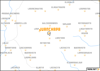
Juan Chapa (Nuevo León, Mexico)Juan Chapa is a town in the Nuevo León region of Mexico. An overview map of the region around Juan Chapa is displayed below.
regional and 3d topo map of Juan Chapa, Mexico ::
Juan Chapa airports ::
The nearest airport is MTY - Monterrey General Mariano Escobedo Intl, located 97.2 km west of Juan Chapa.
Other airports nearby include REX - Reynosa General Lucio Blanco Intl (110.2 km north east), NTR - Monterrey Del Norte Intl (112.6 km west), MFE - Mcallen Mc Allen Miller Intl (119.6 km north east), MAM - Matamoros General Servando Canales Intl (168.8 km east), Nearby towns ::
El Milagro (1.1km south) //
Dulces Nombres (3.7km north) //
La Retama (3.8km south east) //
Retamitas (4.1km south west) //
Las Palmas (3.9km north west) //
San Juan (6.7km north east) //
La Crucita (7.5km south east) //
Buenavista (10.0km south west) //
[all distances 'as the bird flies' and approximate]  Places with similar names to Juan Chapa, Mexico ::
// Joni Chapa (ZM)
// Jianchapu (CN)
Disclaimer :: Information on this page comes without warranty of any kind |
||
|
Where is Juan Chapa? Elevation and coordinates ::
Latitude (lat): 25°31'0"N Longitude (lon): 99°11'0"W
Elevation (approx.): 187m (map arrows pan, magnifying glasses zoom) |
||
|
Visiting Juan Chapa? Hotel/Accommodation ::
Book a hotel in Juan Chapa Travel Guide ::
Buy a travel guide for Mexico rental cars ::
car rental offers GPS waypoint ::
download a GPX waypoint (PoI) of Juan Chapa for your GPS receiver
|
||