|
search place name
|
||
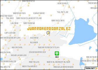
Juan Romero González (Distrito Federal, Mexico)Juan Romero González is a town in the Distrito Federal region of Mexico. An overview map of the region around Juan Romero González is displayed below.
regional and 3d topo map of Juan Romero González, Mexico ::
Juan Romero González airports ::
The nearest airport is MEX - Mexico City Licenciado Benito Juarez Intl, located 7.6 km south of Juan Romero González.
Other airports nearby include TLC - Toluca Licenciado Adolfo Lopez Mateos Intl (52.2 km west), PCA - Pachuca Ingeniero Juan Guillermo Villasana (72.0 km north east), CVJ - Cuernavaca General Mariano Matamoros (75.6 km south), PBC - Puebla Hermanos Serdan Intl (85.4 km south east), Nearby towns ::
Nueva Atzacoalco (0.0km north) //
Gabriel Hernández (0.0km north) //
Gabriel Hernández Ampliación (0.0km north) //
Villahermosa (1.9km south) //
Constitución de la República (1.9km south) //
Salvador Díaz Mirón (1.9km south) //
San Pedro Zacatenco (1.7km west) //
Gustavo A. Madero (2.4km south) //
Xalostoc (2.5km north east) //
San Felipe de Jesús (2.5km north east) //
Faja de Oro (3.7km south) //
Gertrudis Sánchez (3.7km south) //
Vasco de Quiroga (3.7km south) //
Fernando Casas Alemán Ampliación (4.1km south east) //
San Juan de Aragón (4.1km south east) //
Aragón Inguarán (4.1km south west) //
Tres Estrellas (4.1km south west) //
Mártires de Río Blanco (4.1km south west) //
Santa María Ticomán (4.0km north west) //
Guadalupe Insurgentes (5.1km south west) //
Nueva Tenochtitlán (5.6km south) //
Casas Alemán (5.6km south) //
Fernando Casas Alemán (5.6km south) //
San Bartolo Atepehuacán (5.2km west) //
Santa Clara (5.7km north east) //
La Joya (5.8km south) //
Belisario Domínguez (5.8km south) //
Progreso Nacional (5.6km west) //
Defensores de la República (5.6km west) //
[all distances 'as the bird flies' and approximate] 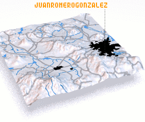 Places with similar names to Juan Romero González, Mexico :: Disclaimer :: Information on this page comes without warranty of any kind |
||
|
Where is Juan Romero González? Elevation and coordinates ::
Latitude (lat): 19°30'0"N Longitude (lon): 99°6'0"W
Elevation (approx.): 2277m (map arrows pan, magnifying glasses zoom) |
||
|
Visiting Juan Romero González? Hotel/Accommodation ::
Book a hotel in Juan Romero González Travel Guide ::
Buy a travel guide for Mexico rental cars ::
car rental offers GPS waypoint ::
download a GPX waypoint (PoI) of Juan Romero González for your GPS receiver
|
||