|
search place name
|
||
La Barranca (San Luis Potosí, Mexico)La Barranca is a town in the San Luis Potosí region of Mexico. An overview map of the region around La Barranca is displayed below.
regional and 3d topo map of La Barranca, Mexico ::

La Barranca airports ::
The nearest airport is SLP - San Luis Potosi Ponciano Arriaga Intl, located 54.8 km north of La Barranca.
Other airports nearby include BJX - Del Bajio Guanajuato Intl (114.6 km south west), QRO - Queretaro Intercontinental (142.5 km south east), AGU - Aguascalientes Jesus Teran Intl (160.7 km west), TSL - Tamuin (204.5 km east), Nearby towns ::
El Soyate (1.7km west) //
Santa María del Río (2.5km north east) //
Guanajuatillo (3.7km north) //
La Cardona (4.1km south east) //
Santa Bárbara (5.6km south) //
El Pueblito (5.6km north) //
Galera (6.4km south west) //
La Cuesta (6.4km north west) //
Negritas (6.9km west) //
Sánchez (6.9km east) //
Cruz de Quiote (8.8km north east) //
[all distances 'as the bird flies' and approximate] 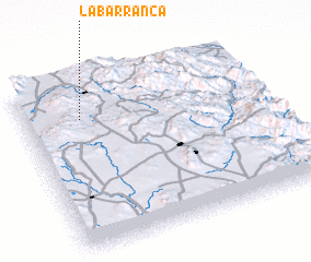 Places with similar names to La Barranca, Mexico ::
// Labrang (PH)
// Lebring (AT)
// Labering (DE)
// La Barranca (PA)
// Lubraniec (PL)
// Luebbering (US)
// La Barranca (CO)
// La Barranca (GT)
// La Barranca (GT)
// La Barranca (GT)
Disclaimer :: Information on this page comes without warranty of any kind |
||
|
Where is La Barranca? Elevation and coordinates ::
Latitude (lat): 21°47'0"N Longitude (lon): 100°46'0"W
Elevation (approx.): 1806m (map arrows pan, magnifying glasses zoom) |
||
|
Visiting La Barranca? Hotel/Accommodation ::
Book a hotel in La Barranca Travel Guide ::
Buy a travel guide for Mexico rental cars ::
car rental offers GPS waypoint ::
download a GPX waypoint (PoI) of La Barranca for your GPS receiver
|
||