|
search place name
|
||
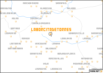
Laborcita de Torres (Chihuahua, Mexico)Laborcita de Torres is a town in the Chihuahua region of Mexico. An overview map of the region around Laborcita de Torres is displayed below.
regional and 3d topo map of Laborcita de Torres, Mexico ::
Laborcita de Torres airports ::
The nearest airport is CUU - Chihuahua General R Fierro Villalobos Intl, located 207.0 km north of Laborcita de Torres.
Nearby towns ::
Estancia (1.9km north) //
Amparanes (2.5km south west) //
La Noria (4.1km south east) //
El Bosque (3.8km south east) //
Corral de Piedras (5.0km north west) //
Vencedora (5.0km south west) //
Obligados (5.6km south) //
Los Álamos (5.3km east) //
Bella Vista (5.3km east) //
Chicanaya (5.8km south) //
Los Solises (6.5km south west) //
El Cura (6.2km south west) //
Casa Colorada (6.9km west) //
El Aguaje (7.6km north) //
Amparanes (6.9km west) //
La Jolla (7.5km north west) //
Zenzontle (7.5km north west) //
La Boquilla (8.1km north west) //
Papelote (7.6km south west) //
San Antonio (8.9km south west) //
Borjas de Flores (8.9km south east) //
Tanquecillos (9.9km north east) //
[all distances 'as the bird flies' and approximate]  Places with similar names to Laborcita de Torres, Mexico :: Disclaimer :: Information on this page comes without warranty of any kind |
||
|
Where is Laborcita de Torres? Elevation and coordinates ::
Latitude (lat): 26°51'0"N Longitude (lon): 105°42'0"W
Elevation (approx.): 1801m (map arrows pan, magnifying glasses zoom) |
||
|
Visiting Laborcita de Torres? Hotel/Accommodation ::
Book a hotel in Laborcita de Torres Travel Guide ::
Buy a travel guide for Mexico rental cars ::
car rental offers GPS waypoint ::
download a GPX waypoint (PoI) of Laborcita de Torres for your GPS receiver
|
||