|
search place name
|
||
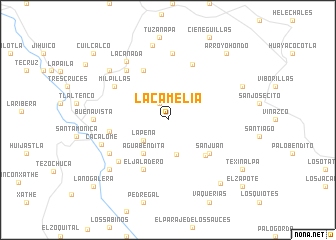
La Camelia (Hidalgo, Mexico)La Camelia is a town in the Hidalgo region of Mexico. An overview map of the region around La Camelia is displayed below.
regional and 3d topo map of La Camelia, Mexico ::
La Camelia airports ::
The nearest airport is PCA - Pachuca Ingeniero Juan Guillermo Villasana, located 48.5 km south of La Camelia.
Other airports nearby include TXA - Tlaxcala (114.1 km south east), PAZ - Poza Rico Tajin (120.4 km east), MEX - Mexico City Licenciado Benito Juarez Intl (125.7 km south west), PBC - Puebla Hermanos Serdan Intl (148.8 km south), Nearby towns ::
La Magnolia (2.0km north west) //
La Peña (3.5km south west) //
Peñas Coloradas (4.0km south) //
Agua Bendita (4.5km south west) //
Los Álamos (5.6km south east) //
San Juan (5.7km south east) //
Santa María Xoxoteco (6.1km north west) //
El Jaladero (6.1km south west) //
Venados (6.2km west) //
Yerbabuena (6.7km north east) //
Milpillas (6.8km north west) //
San Lucas Allende (7.0km south west) //
Metzquititlán (7.1km north west) //
Chichinapa (7.4km north) //
Troje (7.1km south west) //
Cacalomé (7.5km west) //
La Cañada (7.8km north west) //
Buenavista (7.8km west) //
El Banco (8.5km north) //
Atecoxco (8.2km north west) //
Veladero (8.2km south west) //
Tejocotes (8.6km north east) //
El Xithe (9.0km south east) //
Arroyo Hondo (9.6km north east) //
Texinalpa (9.6km south east) //
La Nogalera (10.8km south west) //
El Zapote (10.8km south east) //
Cuilcalco (10.8km north west) //
[all distances 'as the bird flies' and approximate]  Places with similar names to La Camelia, Mexico ::
// Lake Mill (US)
// Łęka Mała (PL)
// Łęki Małe (PL)
// Likomil (AL)
// La Camelia (CO)
// La Camelia (CO)
// La Camelia (CO)
// La Camelia (CO)
// La Camelia (CO)
// La Camelia (CO)
Disclaimer :: Information on this page comes without warranty of any kind |
||
|
Where is La Camelia? Elevation and coordinates ::
Latitude (lat): 20°29'0"N Longitude (lon): 98°36'30"W
Elevation (approx.): 1585m (map arrows pan, magnifying glasses zoom) |
||
|
Visiting La Camelia? Hotel/Accommodation ::
Book a hotel in La Camelia Travel Guide ::
Buy a travel guide for Mexico rental cars ::
car rental offers GPS waypoint ::
download a GPX waypoint (PoI) of La Camelia for your GPS receiver
|
||