|
search place name
|
||
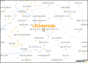
La Comunidad (Veracruz-Llave, Mexico)La Comunidad is a town in the Veracruz-Llave region of Mexico. An overview map of the region around La Comunidad is displayed below.
regional and 3d topo map of La Comunidad, Mexico ::
La Comunidad airports ::
The nearest airport is PAZ - Poza Rico Tajin, located 80.7 km east of La Comunidad.
Other airports nearby include PCA - Pachuca Ingeniero Juan Guillermo Villasana (107.5 km south west), TSL - Tamuin (144.9 km north west), TXA - Tlaxcala (147.1 km south), TAM - Tampico General Francisco Javier Mina Intl (161.7 km north), Nearby towns ::
Ahuica (2.5km north east) //
Sasaltitla (2.5km north west) //
Sesecapa (2.5km south east) //
Hueycuatitla (3.5km east) //
Xochioloco (3.5km west) //
Benito Juárez (4.1km north west) //
Cuachumo (3.9km north west) //
San Miguel (4.1km south west) //
Otlamalacatl (5.1km south west) //
Acoyotla (5.6km south) //
Achupil (5.8km north) //
Chalahuiapa (5.8km north) //
El Lindero (6.4km south east) //
Tlaxcocuatitla (7.4km south) //
Otlatzintla (8.2km south west) //
Ohuatipa (8.2km west) //
Cuatzapotitla (8.9km north east) //
Texoloc (8.9km north west) //
Acanoa (11.4km south west) //
[all distances 'as the bird flies' and approximate] 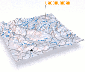 Places with similar names to La Comunidad, Mexico ::
// La Comunidad (SV)
// La Comunidad (GT)
// La Comunidad (GT)
// La Comunidad (GT)
// La Comunidad (MX)
// La Comunidad (MX)
// La Comunidad (MX)
// La Comunidad (MX)
// La Comunidad (MX)
// La Comunidad (MX)
Disclaimer :: Information on this page comes without warranty of any kind |
||
|
Where is La Comunidad? Elevation and coordinates ::
Latitude (lat): 20°52'0"N Longitude (lon): 98°11'0"W
Elevation (approx.): 277m (map arrows pan, magnifying glasses zoom) |
||
|
Visiting La Comunidad? Hotel/Accommodation ::
Book a hotel in La Comunidad Travel Guide ::
Buy a travel guide for Mexico rental cars ::
car rental offers GPS waypoint ::
download a GPX waypoint (PoI) of La Comunidad for your GPS receiver
|
||