|
search place name
|
||
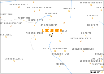
La Cumbre (Oaxaca, Mexico)La Cumbre is a town in the Oaxaca region of Mexico. An overview map of the region around La Cumbre is displayed below.
regional and 3d topo map of La Cumbre, Mexico ::
La Cumbre airports ::
The nearest airport is OAX - Oaxaca Xoxocotlan Intl, located 23.8 km east of La Cumbre.
Other airports nearby include PXM - Puerto Escondido Intl (119.3 km south), HUX - Bahias Dehuatulco Bahias De Huatulco Intl (148.5 km south east), TCN - Tehuacan (179.0 km north), Nearby towns ::
Santiago Clavellinas (3.1km south east) //
Pie de la Cuesta (3.4km north west) //
La Soledad Peras (3.6km north) //
La Pazuela (3.5km east) //
Santa Catarina Mixtepec (5.2km south) //
La Brujería (5.8km west) //
El Gachupin (6.3km north) //
San Miguel Peras (6.1km west) //
San Pablo Cuatro Venados (6.6km north east) //
Magdalena Mixtepec (6.9km south east) //
Asunción Mixtepec (7.5km south) //
Contreras (7.4km north west) //
Portezuelo (7.6km north) //
Loma del Gusto (7.7km north west) //
[all distances 'as the bird flies' and approximate] 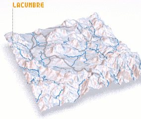 Places with similar names to La Cumbre, Mexico ::
Disclaimer :: Information on this page comes without warranty of any kind |
||
|
Where is La Cumbre? Elevation and coordinates ::
Latitude (lat): 16°56'45"N Longitude (lon): 96°56'35"W
Elevation (approx.): 2647m (map arrows pan, magnifying glasses zoom) |
||
|
Visiting La Cumbre? Hotel/Accommodation ::
Book a hotel in La Cumbre Travel Guide ::
Buy a travel guide for Mexico rental cars ::
car rental offers GPS waypoint ::
download a GPX waypoint (PoI) of La Cumbre for your GPS receiver
|
||