|
search place name
|
||
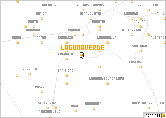
Laguna Verde (San Luis Potosí, Mexico)Laguna Verde is a town in the San Luis Potosí region of Mexico. An overview map of the region around Laguna Verde is displayed below.
regional and 3d topo map of Laguna Verde, Mexico ::
Laguna Verde airports ::
The nearest airport is SLP - San Luis Potosi Ponciano Arriaga Intl, located 64.7 km north east of Laguna Verde.
Other airports nearby include BJX - Del Bajio Guanajuato Intl (95.4 km south), AGU - Aguascalientes Jesus Teran Intl (98.0 km west), ZCL - Zacatecas General Leobardo C Ruiz Intl (177.4 km north west), QRO - Queretaro Intercontinental (184.6 km south east), Nearby towns ::
Lagunita (3.4km west) //
Maguey (3.9km north east) //
Puerto del Refugio (3.9km south east) //
San Juan (3.9km north west) //
Providencia (4.9km south west) //
Canalizo (5.1km north west) //
San Isidro (5.1km south west) //
Arriaga (5.6km north) //
Franco (5.8km north) //
La Boreilla (6.4km north east) //
Conos (6.5km south west) //
La Paloma (7.3km north east) //
Cieneguita (7.1km east) //
Laguna de Guadalupe (7.6km south east) //
Agustín (8.2km north east) //
[all distances 'as the bird flies' and approximate] 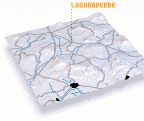 Places with similar names to Laguna Verde, Mexico ::
// Laguna Verde (CL)
// Laguna Verde (CO)
// Laguna Verde (GT)
// Laguna Verde (MX)
// Laguna Verde (MX)
// Laguna Verde (MX)
// Laguna Verde (MX)
// Laguna Verde (MX)
// Laguna Verde (HN)
// Laguna Verde (HN)
Disclaimer :: Information on this page comes without warranty of any kind |
||
|
Where is Laguna Verde? Elevation and coordinates ::
Latitude (lat): 21°51'0"N Longitude (lon): 101°23'0"W
Elevation (approx.): 2241m (map arrows pan, magnifying glasses zoom) |
||
|
Visiting Laguna Verde? Hotel/Accommodation ::
Book a hotel in Laguna Verde Travel Guide ::
Buy a travel guide for Mexico rental cars ::
car rental offers GPS waypoint ::
download a GPX waypoint (PoI) of Laguna Verde for your GPS receiver
|
||