|
search place name
|
||
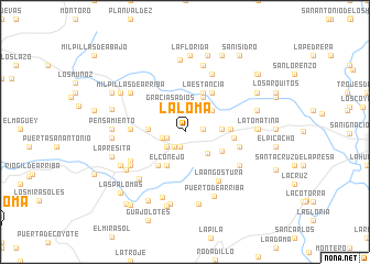
La Loma (Aguascalientes, Mexico)La Loma is a town in the Aguascalientes region of Mexico. An overview map of the region around La Loma is displayed below.
regional and 3d topo map of La Loma, Mexico ::
La Loma airports ::
The nearest airport is AGU - Aguascalientes Jesus Teran Intl, located 27.3 km south east of La Loma.
Other airports nearby include ZCL - Zacatecas General Leobardo C Ruiz Intl (112.7 km north), BJX - Del Bajio Guanajuato Intl (144.3 km south east), SLP - San Luis Potosi Ponciano Arriaga Intl (165.0 km east), GDL - Guadalajara Don Miguel Hidalgo Y Costilla Intl (174.9 km south west), Nearby towns ::
San Isidro (1.6km south) //
Cañada del Rodeo (1.7km east) //
El Llano (1.8km south west) //
Pedernal (1.8km west) //
Las Bóvedas (2.4km north) //
Puerta Los Toros (2.2km west) //
San José del Llano (2.3km south west) //
Gracias a Dios (3.0km north west) //
General Ignacio Zaragoza (3.0km south east) //
San José de Guadalupe (3.4km north east) //
La Soledad de los Medina (3.5km east) //
El Rincón (3.5km west) //
La Puerta del Llano (3.8km south west) //
El Conejo (3.8km south west) //
El Zapote (3.9km north east) //
Buenavista (4.0km south east) //
Piedras Negras (4.3km south west) //
La Estancia (4.4km north east) //
La Presita (4.3km east) //
Cañada Ancha (4.8km north east) //
La Agua María (4.6km east) //
El Pedernal (5.2km west) //
El Venaderito (5.4km east) //
La Angostura (5.9km south east) //
Carboneras (5.9km south east) //
La Fortuna (5.9km south west) //
La Soledad (6.4km north east) //
Tapias Viejas (6.2km south west) //
La Providencia (6.2km south east) //
[all distances 'as the bird flies' and approximate]  Places with similar names to La Loma, Mexico ::
Disclaimer :: Information on this page comes without warranty of any kind |
||
|
Where is La Loma? Elevation and coordinates ::
Latitude (lat): 21°53'50"N Longitude (lon): 102°29'0"W
Elevation (approx.): 2016m (map arrows pan, magnifying glasses zoom) |
||
|
Visiting La Loma? Hotel/Accommodation ::
Book a hotel in La Loma Travel Guide ::
Buy a travel guide for Mexico rental cars ::
car rental offers GPS waypoint ::
download a GPX waypoint (PoI) of La Loma for your GPS receiver
|
||