|
search place name
|
||
La Morena (San Luis Potosí, Mexico)La Morena is a town in the San Luis Potosí region of Mexico. An overview map of the region around La Morena is displayed below.
regional and 3d topo map of La Morena, Mexico ::

La Morena airports ::
The nearest airport is TSL - Tamuin, located 45.4 km north east of La Morena.
Other airports nearby include TAM - Tampico General Francisco Javier Mina Intl (144.2 km north east), QRO - Queretaro Intercontinental (168.0 km south west), SLP - San Luis Potosi Ponciano Arriaga Intl (191.1 km west), PCA - Pachuca Ingeniero Juan Guillermo Villasana (192.7 km south), Nearby towns ::
El Ranchito (1.9km south) //
Tamal (2.5km north west) //
Tanchachín (3.7km north) //
San José el Viejo (4.1km south west) //
Sabinal (5.1km south east) //
Osmolón (5.6km south) //
El Tamui (5.5km west) //
Puerto (7.6km south) //
La Calera (8.2km south east) //
Urraca (8.8km north east) //
El Naranjito (9.0km north west) //
Chuchupe (10.1km north east) //
[all distances 'as the bird flies' and approximate] 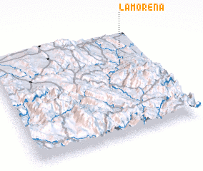 Places with similar names to La Morena, Mexico ::
// La Méreune (CH)
// Lumbrein (CH)
// Lomorni (ET)
// La Marina (PA)
// La Marina (IT)
// La Mariana (CU)
// La Mariana (CU)
// La Maraña (ES)
// La Mariana (ES)
// La Marina (ES)
Disclaimer :: Information on this page comes without warranty of any kind |
||
|
Where is La Morena? Elevation and coordinates ::
Latitude (lat): 21°47'0"N Longitude (lon): 99°9'0"W
Elevation (approx.): 476m (map arrows pan, magnifying glasses zoom) |
||
|
Visiting La Morena? Hotel/Accommodation ::
Book a hotel in La Morena Travel Guide ::
Buy a travel guide for Mexico rental cars ::
car rental offers GPS waypoint ::
download a GPX waypoint (PoI) of La Morena for your GPS receiver
|
||