|
search place name
|
||
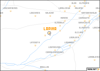
La Pima (Sonora, Mexico)La Pima is a town in the Sonora region of Mexico. An overview map of the region around La Pima is displayed below.
regional and 3d topo map of La Pima, Mexico ::
La Pima airports ::
The nearest airport is NOG - Nogales Intl, located 87.4 km north of La Pima.
Other airports nearby include FHU - Fort Huachuca Sierra Vista Muni Libby Aaf (151.8 km north east), HMO - Hermosillo General Ignacio P Garcia Intl (155.5 km south), TUS - Tucson Intl (183.9 km north), DMA - Tucson Davis Monthan Afb (190.5 km north), Nearby towns ::
La Noria (1.6km west) //
Los Cúmaros (1.6km west) //
El Álamo (3.7km north east) //
El Rebaje (4.9km north east) //
Los Fresnos (5.8km south) //
La Tesota (6.1km south west) //
Salazar (7.4km north) //
Corral de Espinas (7.6km south) //
Moreno (7.3km north east) //
Los Haros (7.4km south east) //
Los Chinos (8.8km north west) //
[all distances 'as the bird flies' and approximate] 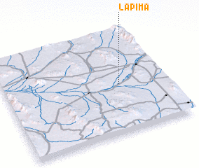 Places with similar names to La Pima, Mexico ::
Disclaimer :: Information on this page comes without warranty of any kind |
||
|
Where is La Pima? Elevation and coordinates ::
Latitude (lat): 30°29'0"N Longitude (lon): 111°17'0"W
Elevation (approx.): 611m (map arrows pan, magnifying glasses zoom) |
||
|
Visiting La Pima? Hotel/Accommodation ::
Book a hotel in La Pima Travel Guide ::
Buy a travel guide for Mexico rental cars ::
car rental offers GPS waypoint ::
download a GPX waypoint (PoI) of La Pima for your GPS receiver
|
||