|
search place name
|
||
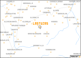
Las Tuzas (Guanajuato, Mexico)Las Tuzas is a town in the Guanajuato region of Mexico. An overview map of the region around Las Tuzas is displayed below.
regional and 3d topo map of Las Tuzas, Mexico ::
Las Tuzas airports ::
The nearest airport is QRO - Queretaro Intercontinental, located 43.4 km south of Las Tuzas.
Other airports nearby include BJX - Del Bajio Guanajuato Intl (123.5 km west), MLM - Morelia General Francisco J Mujica Intl (148.1 km south west), SLP - San Luis Potosi Ponciano Arriaga Intl (154.2 km north west), PCA - Pachuca Ingeniero Juan Guillermo Villasana (187.5 km south east), Nearby towns ::
Ojo de Agua del Refugio (2.1km north west) //
Rincón de Santa Anita (2.6km south west) //
Garabatillo (3.0km south east) //
Arroyo de Medina (4.1km south west) //
Cruces (4.2km south east) //
Santa Anita (4.4km north west) //
El Capulín (4.9km north west) //
El Conejo (6.4km west) //
Piñones (6.6km east) //
Carbajal (7.1km north east) //
El Magueyal (8.3km north) //
Rincón de Cano (8.3km north east) //
Garabatillo (8.8km south) //
La Tinaja (9.2km north) //
El Cano (10.1km north east) //
La Escondida (11.0km north west) //
[all distances 'as the bird flies' and approximate] 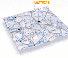 Places with similar names to Las Tuzas, Mexico ::
// Los Tiesos (PA)
// Las Tusas (CU)
// Las Tusas (US)
// Las Tizas (CL)
// Las Tazas (CO)
// Los Deseos (CO)
// Los Deseos (CO)
// Los Deseos (CO)
// Los Deseos (CO)
// Los Deseos (CO)
Disclaimer :: Information on this page comes without warranty of any kind |
||
|
Where is Las Tuzas? Elevation and coordinates ::
Latitude (lat): 20°59'45"N Longitude (lon): 100°17'34"W
Elevation (approx.): 2267m (map arrows pan, magnifying glasses zoom) |
||
|
Visiting Las Tuzas? Hotel/Accommodation ::
Book a hotel in Las Tuzas Travel Guide ::
Buy a travel guide for Mexico rental cars ::
car rental offers GPS waypoint ::
download a GPX waypoint (PoI) of Las Tuzas for your GPS receiver
|
||