|
search place name
|
||
Los Cerdas (Guanajuato, Mexico)Los Cerdas is a town in the Guanajuato region of Mexico. An overview map of the region around Los Cerdas is displayed below.
regional and 3d topo map of Los Cerdas, Mexico ::

Los Cerdas airports ::
The nearest airport is BJX - Del Bajio Guanajuato Intl, located 55.1 km west of Los Cerdas.
Other airports nearby include QRO - Queretaro Intercontinental (102.9 km south east), SLP - San Luis Potosi Ponciano Arriaga Intl (120.6 km north), MLM - Morelia General Francisco J Mujica Intl (145.8 km south), AGU - Aguascalientes Jesus Teran Intl (150.7 km north west), Nearby towns ::
Los Carrizos (1.6km south) //
Los Cema (1.7km west) //
El Gallinero (3.1km north east) //
Los Hernández (3.5km west) //
La Presa (4.1km north) //
Joconoxtlito (4.7km south east) //
Palmilla (4.9km south west) //
Dolores Hidalgo (5.6km east) //
Tierra Blanca (6.5km south east) //
El Llanito (6.5km south east) //
Las Crucitas (6.6km east) //
El Gusano (6.7km south west) //
San Martín (6.7km west) //
San Pablo (7.2km east) //
El Terrero (7.2km west) //
Río Laja (7.5km north east) //
La Purísima (7.7km south west) //
Las Palmillas (8.2km north) //
El Rincón (7.8km north east) //
La Laja (8.2km south east) //
San José de la Palma (8.2km south east) //
Los Arcos (8.3km north east) //
Refugio de Trancas (8.5km west) //
El Capulín (8.8km south west) //
Aguilillas (9.0km north west) //
El Molino (9.7km north east) //
Tecolote (10.8km north west) //
Las Lozas (11.5km south west) //
[all distances 'as the bird flies' and approximate] 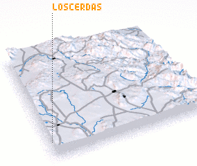 Places with similar names to Los Cerdas, Mexico ::
// Los Cerritos (US)
// Los Cerritos (PA)
// Los Cerritos (PA)
// Los Cerritos (PA)
// Los Cerritos (PA)
// Los Cerritos (PA)
// Los Cerritos (PA)
// Los Cerritos (PA)
// Los Cerritos (PA)
// Los Cerritos (PA)
Disclaimer :: Information on this page comes without warranty of any kind |
||
|
Where is Los Cerdas? Elevation and coordinates ::
Latitude (lat): 21°10'0"N Longitude (lon): 100°59'0"W
Elevation (approx.): 2008m (map arrows pan, magnifying glasses zoom) |
||
|
Visiting Los Cerdas? Hotel/Accommodation ::
Book a hotel in Los Cerdas Travel Guide ::
Buy a travel guide for Mexico rental cars ::
car rental offers GPS waypoint ::
download a GPX waypoint (PoI) of Los Cerdas for your GPS receiver
|
||