|
search place name
|
||
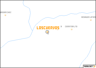
Los Cuervos (Durango, Mexico)Los Cuervos is a town in the Durango region of Mexico. An overview map of the region around Los Cuervos is displayed below.
regional and 3d topo map of Los Cuervos, Mexico ::
Los Cuervos airports ::
The nearest airport is DGO - Durango Intl, located 113.5 km north of Los Cuervos.
Other airports nearby include MZT - Mazatlan General Rafael Buelna Intl (157.1 km west), TPQ - Tepic (188.3 km south), Nearby towns ::
Teneraca (3.9km north east) //
[all distances 'as the bird flies' and approximate] 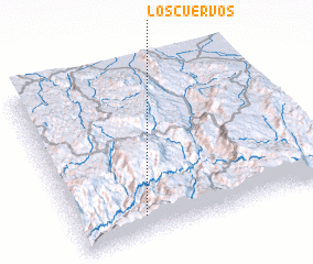 Places with similar names to Los Cuervos, Mexico ::
// Los Cuervos (CO)
// Los Cuervos (GT)
// Los Cuervos (MX)
// Las Curvas (VE)
// Las Curvas (VE)
// Los Cuervos (DO)
// Les Corvées (FR)
// Les Graves (FR)
// Les Gravues (FR)
// Les Grèves (FR)
Disclaimer :: Information on this page comes without warranty of any kind |
||
|
Where is Los Cuervos? Elevation and coordinates ::
Latitude (lat): 23°7'0"N Longitude (lon): 104°44'0"W
Elevation (approx.): 2048m (map arrows pan, magnifying glasses zoom) |
||
|
Visiting Los Cuervos? Hotel/Accommodation ::
Book a hotel in Los Cuervos Travel Guide ::
Buy a travel guide for Mexico rental cars ::
car rental offers GPS waypoint ::
download a GPX waypoint (PoI) of Los Cuervos for your GPS receiver
|
||