|
search place name
|
||
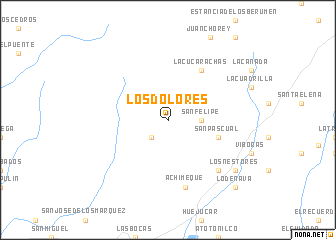
Los Dolores (Zacatecas, Mexico)Los Dolores is a town in the Zacatecas region of Mexico. An overview map of the region around Los Dolores is displayed below.
regional and 3d topo map of Los Dolores, Mexico ::
Los Dolores airports ::
The nearest airport is ZCL - Zacatecas General Leobardo C Ruiz Intl, located 76.2 km north east of Los Dolores.
Other airports nearby include AGU - Aguascalientes Jesus Teran Intl (126.7 km south east), TPQ - Tepic (200.2 km south west), GDL - Guadalajara Don Miguel Hidalgo Y Costilla Intl (213.6 km south), DGO - Durango Intl (226.9 km north west), Nearby towns ::
Saucillo (2.5km south west) //
San Felipe (3.4km east) //
Láaro Cárdenas (3.4km east) //
San Pascual (5.5km east) //
La Cucarachas (6.5km north east) //
Achimeque (7.6km south) //
El Terrero (7.6km south east) //
Los Nestores (8.8km south east) //
Lo de Nava (10.1km south east) //
[all distances 'as the bird flies' and approximate] 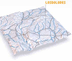 Places with similar names to Los Dolores, Mexico ::
// Las Dolores (CU)
// Los Dolores (CU)
// Los Dolores (ES)
// Los Dolores (ES)
// Los Dolores (GT)
// Los Dolores (MX)
// Los Dolores (MX)
// Los Dolores (MX)
// Los Dolores (MX)
// Los Dolores (MX)
Disclaimer :: Information on this page comes without warranty of any kind |
||
|
Where is Los Dolores? Elevation and coordinates ::
Latitude (lat): 22°27'0"N Longitude (lon): 103°15'0"W
Elevation (approx.): 2017m (map arrows pan, magnifying glasses zoom) |
||
|
Visiting Los Dolores? Hotel/Accommodation ::
Book a hotel in Los Dolores Travel Guide ::
Buy a travel guide for Mexico rental cars ::
car rental offers GPS waypoint ::
download a GPX waypoint (PoI) of Los Dolores for your GPS receiver
|
||