|
search place name
|
||
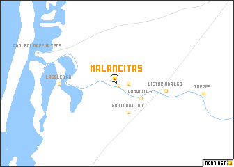
Malancitas (Baja California Sur, Mexico)Malancitas is a town in the Baja California Sur region of Mexico. An overview map of the region around Malancitas is displayed below.
regional and 3d topo map of Malancitas, Mexico ::
Malancitas airports ::
The nearest airport is LTO - Loreto Intl, located 113.7 km north east of Malancitas.
Other airports nearby include LAP - La Paz General Manuel Marquez De Leon Intl (204.4 km south east), Nearby towns ::
Matancitas (0.5km south east) //
Matancita (1.7km east) //
Ramaditas (4.2km south east) //
Santa Martha (4.9km south) //
Victor Hidalgo (7.2km east) //
[all distances 'as the bird flies' and approximate] 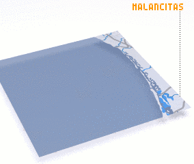 Places with similar names to Malancitas, Mexico :: Disclaimer :: Information on this page comes without warranty of any kind |
||
|
Where is Malancitas? Elevation and coordinates ::
Latitude (lat): 25°9'3"N Longitude (lon): 112°0'1"W
Elevation (approx.): 17m (map arrows pan, magnifying glasses zoom) |
||
|
Visiting Malancitas? Hotel/Accommodation ::
Book a hotel in Malancitas Travel Guide ::
Buy a travel guide for Mexico rental cars ::
car rental offers GPS waypoint ::
download a GPX waypoint (PoI) of Malancitas for your GPS receiver
|
||