|
search place name
|
||
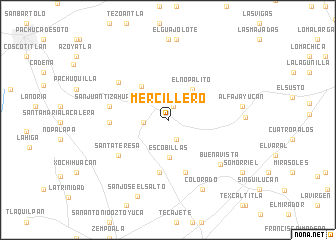
Mercillero (Hidalgo, Mexico)Mercillero is a town in the Hidalgo region of Mexico. An overview map of the region around Mercillero is displayed below.
regional and 3d topo map of Mercillero, Mexico ::
Mercillero airports ::
The nearest airport is PCA - Pachuca Ingeniero Juan Guillermo Villasana, located 18.8 km west of Mercillero.
Other airports nearby include TXA - Tlaxcala (71.5 km south east), MEX - Mexico City Licenciado Benito Juarez Intl (82.3 km south west), PBC - Puebla Hermanos Serdan Intl (100.3 km south), TLC - Toluca Licenciado Adolfo Lopez Mateos Intl (126.8 km south west), Nearby towns ::
El Ocote (1.6km north) //
Jalapilla (2.3km south) //
Epazoyucan (2.6km west) //
Escobillas (4.2km south) //
El Nopalito (4.3km north east) //
Xolostilla (4.6km north west) //
Santa Mónica (5.9km south) //
San Cristóbal El Grande (6.2km south) //
Palacio (6.1km west) //
San Juan Tizahuapan (6.3km west) //
Santa Teresa (6.6km south west) //
Barrio Tizahuapán (6.7km north west) //
Buenavista (7.4km south east) //
Alfajayucan (8.0km east) //
Colorado (8.5km south east) //
Matías Rodríguez (8.1km east) //
San José El Salto (9.1km south) //
Somorriel (9.8km south east) //
[all distances 'as the bird flies' and approximate]  Places with similar names to Mercillero, Mexico ::
// Mirzǝlǝr (AZ)
// Marseiller (IT)
// Marzolara (IT)
// Murzeleira (PT)
// Maraşlar (TR)
// Mürseller (TR)
// Mürseller (TR)
// Mboursou Léré (TD)
// Marcellaire (FR)
Disclaimer :: Information on this page comes without warranty of any kind |
||
|
Where is Mercillero? Elevation and coordinates ::
Latitude (lat): 20°2'10"N Longitude (lon): 98°36'30"W
Elevation (approx.): 2515m (map arrows pan, magnifying glasses zoom) |
||
|
Visiting Mercillero? Hotel/Accommodation ::
Book a hotel in Mercillero Travel Guide ::
Buy a travel guide for Mexico rental cars ::
car rental offers GPS waypoint ::
download a GPX waypoint (PoI) of Mercillero for your GPS receiver
|
||