|
search place name
|
||
Mesa de Frís (Zacatecas, Mexico)Mesa de Frís is a town in the Zacatecas region of Mexico. An overview map of the region around Mesa de Frís is displayed below.
regional and 3d topo map of Mesa de Frís, Mexico ::

Mesa de Frís airports ::
The nearest airport is AGU - Aguascalientes Jesus Teran Intl, located 72.1 km north east of Mesa de Frís.
Other airports nearby include GDL - Guadalajara Don Miguel Hidalgo Y Costilla Intl (109.1 km south), BJX - Del Bajio Guanajuato Intl (161.5 km east), ZCL - Zacatecas General Leobardo C Ruiz Intl (162.7 km north), ZMM - Zamora (171.0 km south east), Nearby towns ::
El Capulincito (3.3km north west) //
Capulín de Abajo (3.2km north east) //
La Cuartilla (5.6km north) //
El Ayo (6.1km west) //
Paso de la Canoa (7.0km south west) //
Francisco I. Madero (7.0km west) //
El Jagüey (7.5km north) //
Palma Cuata (7.1km north west) //
Palo Herrado (7.5km south) //
El Sitio (8.0km east) //
El Zalate (8.9km south west) //
La Virgen (8.9km south east) //
El Fresno (10.1km south west) //
Ojo de Agua (10.7km north east) //
[all distances 'as the bird flies' and approximate] 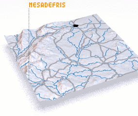 Places with similar names to Mesa de Frís, Mexico :: Disclaimer :: Information on this page comes without warranty of any kind |
||
|
Where is Mesa de Frís? Elevation and coordinates ::
Latitude (lat): 21°27'0"N Longitude (lon): 102°57'30"W
Elevation (approx.): 2184m (map arrows pan, magnifying glasses zoom) |
||
|
Visiting Mesa de Frís? Hotel/Accommodation ::
Book a hotel in Mesa de Frís Travel Guide ::
Buy a travel guide for Mexico rental cars ::
car rental offers GPS waypoint ::
download a GPX waypoint (PoI) of Mesa de Frís for your GPS receiver
|
||