|
search place name
|
||
Metates (Durango, Mexico)Metates is a town in the Durango region of Mexico. An overview map of the region around Metates is displayed below.
regional and 3d topo map of Metates, Mexico ::

Metates airports ::
The nearest airport is DGO - Durango Intl, located 35.6 km north east of Metates.
Other airports nearby include MZT - Mazatlan General Rafael Buelna Intl (171.3 km south west), TRC - Torreon Intl (228.4 km north east), Nearby towns ::
Nicolás (1.9km north) //
General Máximo Garcia (1.7km east) //
El Chorizo (3.7km south) //
Elena (3.9km south east) //
San José del Pajarito (5.0km north west) //
Dieciséis de Septiembre (5.2km north east) //
El Palmito (5.4km west) //
Nevería (7.1km north west) //
Palos Colorados (11.2km north west) //
[all distances 'as the bird flies' and approximate] 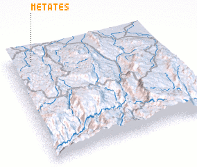 Places with similar names to Metates, Mexico ::
// Meadow Woods (US)
// Mautitz (DE)
// Mãe de Deus (PT)
// Medados (PT)
// Medio Dos (CU)
// Medtsy (UA)
// Mditsy (RU)
// Metates (MX)
// Metates (MX)
// Metates (MX)
Disclaimer :: Information on this page comes without warranty of any kind |
||
|
Where is Metates? Elevation and coordinates ::
Latitude (lat): 23°58'0"N Longitude (lon): 104°50'0"W
Elevation (approx.): 2307m (map arrows pan, magnifying glasses zoom) |
||
|
Visiting Metates? Hotel/Accommodation ::
Book a hotel in Metates Travel Guide ::
Buy a travel guide for Mexico rental cars ::
car rental offers GPS waypoint ::
download a GPX waypoint (PoI) of Metates for your GPS receiver
|
||