|
search place name
|
||
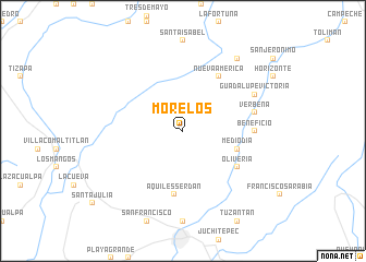
Morelos (Chiapas, Mexico)Morelos is a town in the Chiapas region of Mexico. An overview map of the region around Morelos is displayed below.
regional and 3d topo map of Morelos, Mexico ::
Morelos airports ::
The nearest airport is TAP - Tapachula Intl, located 49.7 km south of Morelos.
Other airports nearby include TGZ - Tuxtla Gutierrez Angel Albino Corzo (158.7 km north), GUA - Guatemala City La Aurora (220.7 km east), Nearby towns ::
Mediodía (5.7km east) //
Aquiles Serdán (6.5km south) //
Oliveria (6.5km south east) //
Nueva América (6.6km north east) //
Aztecas (7.2km east) //
Beneficio (7.2km east) //
Verbena (7.4km east) //
Guadalupe Victoria (8.1km north east) //
La Esperanza (9.2km north east) //
[all distances 'as the bird flies' and approximate] 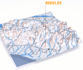 Places with similar names to Morelos, Mexico ::
// Morles (DE)
// Morlesau (DE)
// Maureles (PT)
// Meireles (PT)
// Merlães (PT)
// Mourelos (PT)
// Mourelos (PT)
// María Luisa (CU)
// María Luisa (CU)
// María Luisa (CU)
Disclaimer :: Information on this page comes without warranty of any kind |
||
|
Where is Morelos? Elevation and coordinates ::
Latitude (lat): 15°14'0"N Longitude (lon): 92°28'0"W
Elevation (approx.): 1346m (map arrows pan, magnifying glasses zoom) |
||
|
Visiting Morelos? Hotel/Accommodation ::
Book a hotel in Morelos Travel Guide ::
Buy a travel guide for Mexico rental cars ::
car rental offers GPS waypoint ::
download a GPX waypoint (PoI) of Morelos for your GPS receiver
|
||