|
search place name
|
||
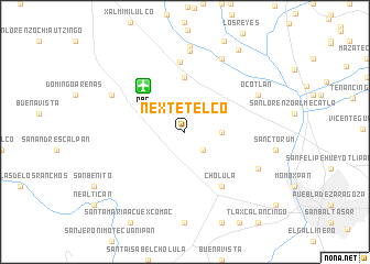
Nextetelco (Puebla, Mexico)Nextetelco is a town in the Puebla region of Mexico. An overview map of the region around Nextetelco is displayed below.
regional and 3d topo map of Nextetelco, Mexico ::
Nextetelco airports ::
The nearest airport is PBC - Puebla Hermanos Serdan Intl, located 6.1 km north west of Nextetelco.
Other airports nearby include TXA - Tlaxcala (49.6 km north), MEX - Mexico City Licenciado Benito Juarez Intl (85.3 km north west), CVJ - Cuernavaca General Mariano Matamoros (102.6 km west), PCA - Pachuca Ingeniero Juan Guillermo Villasana (116.3 km north west), Nearby towns ::
Cuanala (2.5km south east) //
Ometoxtla (2.5km south east) //
Santa María Coronanco (3.5km east) //
Tlaltenango (5.6km north) //
Cholula (6.6km south east) //
San Miguel Analco (7.1km north) //
Santa Clara (8.2km north) //
Ocotlán (7.9km north east) //
San Miguel Xoxtla (8.2km north east) //
Cuautlancingo (7.9km south east) //
Huejotzingo (7.9km north west) //
Los Pinos (8.7km north) //
Santeagueda (9.8km north east) //
[all distances 'as the bird flies' and approximate] 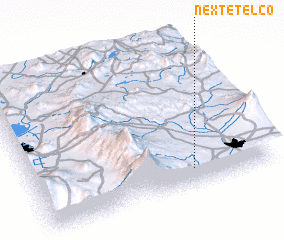 Places with similar names to Nextetelco, Mexico :: Disclaimer :: Information on this page comes without warranty of any kind |
||
|
Where is Nextetelco? Elevation and coordinates ::
Latitude (lat): 19°7'0"N Longitude (lon): 98°20'0"W
Elevation (approx.): 2201m (map arrows pan, magnifying glasses zoom) |
||
|
Visiting Nextetelco? Hotel/Accommodation ::
Book a hotel in Nextetelco Travel Guide ::
Buy a travel guide for Mexico rental cars ::
car rental offers GPS waypoint ::
download a GPX waypoint (PoI) of Nextetelco for your GPS receiver
|
||