|
search place name
|
||
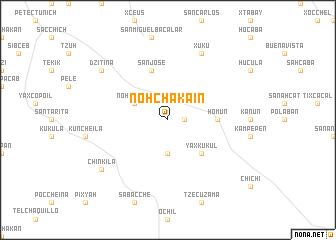
Nohchakain (Yucatán, Mexico)Nohchakain is a town in the Yucatán region of Mexico. An overview map of the region around Nohchakain is displayed below.
regional and 3d topo map of Nohchakain, Mexico ::
Nohchakain airports ::
The nearest airport is MID - Merida Licenciado Manuel Crescencio Rejon Int, located 40.6 km north west of Nohchakain.
Other airports nearby include CPE - Campeche Ingeniero Alberto Acuna Ongay Intl (158.6 km south west), Nearby towns ::
Cuzamá (1.7km east) //
Chunkanán (3.7km south) //
Nohchakán (3.9km north west) //
Yaxkukul (5.1km south east) //
Homún (5.2km east) //
San José (5.8km north) //
Xukú (8.2km north east) //
Dzitiná (8.9km north west) //
Chinkilá (8.9km south west) //
[all distances 'as the bird flies' and approximate] 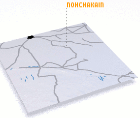 Places with similar names to Nohchakain, Mexico ::
// Nechkino (UA)
// Nechkino (RU)
// Neshkan (RU)
// Niechokunia (GH)
// Nohchakán (MX)
// New Shagunnu (NG)
// Nishi-gōne (JP)
// Niushiquan (CN)
Disclaimer :: Information on this page comes without warranty of any kind |
||
|
Where is Nohchakain? Elevation and coordinates ::
Latitude (lat): 20°44'0"N Longitude (lon): 89°20'0"W
Elevation (approx.): 16m (map arrows pan, magnifying glasses zoom) |
||
|
Visiting Nohchakain? Hotel/Accommodation ::
Book a hotel in Nohchakain Travel Guide ::
Buy a travel guide for Mexico rental cars ::
car rental offers GPS waypoint ::
download a GPX waypoint (PoI) of Nohchakain for your GPS receiver
|
||