|
search place name
|
||
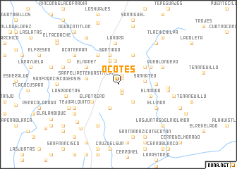
Ocotes (México, Mexico)Ocotes is a town in the México region of Mexico. An overview map of the region around Ocotes is displayed below.
regional and 3d topo map of Ocotes, Mexico ::
Ocotes airports ::
The nearest airport is CVJ - Cuernavaca General Mariano Matamoros, located 100.4 km east of Ocotes.
Other airports nearby include TLC - Toluca Licenciado Adolfo Lopez Mateos Intl (102.4 km north east), MEX - Mexico City Licenciado Benito Juarez Intl (147.8 km north east), MLM - Morelia General Francisco J Mujica Intl (161.7 km north west), ZIH - Ixtapa Zihuatanejo Intl (176.0 km south west), Nearby towns ::
Coatepec (1.0km north east) //
Tlatlaya (1.0km south east) //
La Cofradía (1.5km south) //
La Cueva (1.5km north) //
Acatempa (3.1km north west) //
Tzicatecoyan (3.5km south east) //
Tetitlán (3.5km south east) //
El Paraje (3.7km north) //
Teopazun (3.9km north) //
Puerto de la Arena (3.9km south) //
San Mateo (4.0km east) //
Santiago (4.8km north) //
Amatepec (4.8km north east) //
El Potrero (4.8km south west) //
San Felipe Tehuastitlán (4.9km west) //
Los Espinos (5.1km north east) //
El Mango (5.2km east) //
Los Encinos (5.6km north west) //
El Zapote (5.6km north east) //
El Mamey (5.6km north west) //
La Fragua (5.7km east) //
La Mora (6.5km north) //
El Limón (6.8km south east) //
Santa Ana Zicatecoyan (7.2km south west) //
Pueblo Nuevo (7.1km north east) //
Tejupilquito (7.6km south west) //
Quadrilla de Flores (7.5km east) //
San Mateo (7.5km east) //
El Suchual (8.1km south west) //
[all distances 'as the bird flies' and approximate]  Places with similar names to Ocotes, Mexico ::
Disclaimer :: Information on this page comes without warranty of any kind |
||
|
Where is Ocotes? Elevation and coordinates ::
Latitude (lat): 18°37'30"N Longitude (lon): 100°11'15"W
Elevation (approx.): 1314m (map arrows pan, magnifying glasses zoom) |
||
|
Visiting Ocotes? Hotel/Accommodation ::
Book a hotel in Ocotes Travel Guide ::
Buy a travel guide for Mexico rental cars ::
car rental offers GPS waypoint ::
download a GPX waypoint (PoI) of Ocotes for your GPS receiver
|
||