|
search place name
|
||
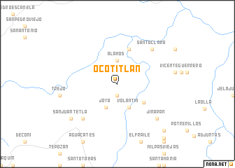
Ocotitlán (Querétaro de Arteaga, Mexico)Ocotitlán is a town in the Querétaro de Arteaga region of Mexico. An overview map of the region around Ocotitlán is displayed below.
regional and 3d topo map of Ocotitlán, Mexico ::
Ocotitlán airports ::
The nearest airport is QRO - Queretaro Intercontinental, located 93.9 km south west of Ocotitlán.
Other airports nearby include PCA - Pachuca Ingeniero Juan Guillermo Villasana (123.9 km south east), TSL - Tamuin (127.1 km north east), MEX - Mexico City Licenciado Benito Juarez Intl (180.1 km south), TLC - Toluca Licenciado Adolfo Lopez Mateos Intl (188.6 km south), Nearby towns ::
Naranjos (1.9km south) //
Álamos (3.7km north) //
Carrizal (3.7km north) //
Joya (4.1km south west) //
Volantín (4.1km south east) //
Mixquiahuales (4.9km south east) //
Los Pelones (5.8km north) //
El Apartadero (7.6km south west) //
Santa Clara (7.6km north east) //
Jinapán (8.1km south east) //
San Juan Tetla (8.9km south west) //
Jiliapan (10.1km south east) //
Saucillo (11.1km south east) //
[all distances 'as the bird flies' and approximate] 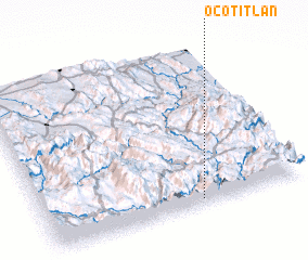
Disclaimer :: Information on this page comes without warranty of any kind |
||
|
Where is Ocotitlán? Elevation and coordinates ::
Latitude (lat): 21°2'0"N Longitude (lon): 99°24'0"W
Elevation (approx.): 1760m (map arrows pan, magnifying glasses zoom) |
||
|
Visiting Ocotitlán? Hotel/Accommodation ::
Book a hotel in Ocotitlán Travel Guide ::
Buy a travel guide for Mexico rental cars ::
car rental offers GPS waypoint ::
download a GPX waypoint (PoI) of Ocotitlán for your GPS receiver
|
||