|
search place name
|
||
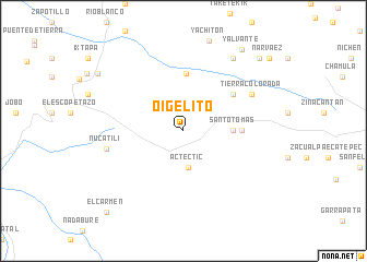
Oigelito (Chiapas, Mexico)Oigelito is a town in the Chiapas region of Mexico. An overview map of the region around Oigelito is displayed below.
regional and 3d topo map of Oigelito, Mexico ::
Oigelito airports ::
The nearest airport is TGZ - Tuxtla Gutierrez Angel Albino Corzo, located 28.3 km south west of Oigelito.
Other airports nearby include VSA - Villahermosa C P A Carlos Rovirosa Intl (139.9 km north), TAP - Tapachula Intl (220.1 km south), CME - Ciudad Del Carmen Intl (239.0 km north east), MTT - Minatitlan (240.0 km north west), Nearby towns ::
Actectic (3.7km south) //
Santo Tomás (4.9km east) //
Francisco Romo Serrano (5.9km north) //
Navenchauc (5.8km east) //
Burrero (6.1km north east) //
Tierra Colorada (7.6km north east) //
Tierra Blanca (7.6km north east) //
Nucatili (7.8km west) //
El Paraíso (8.9km north east) //
Yalvante (10.1km north east) //
Cañitas (10.3km north west) //
Latzbilton (10.5km north east) //
El Carmen (11.2km south west) //
Narváez (11.2km north east) //
[all distances 'as the bird flies' and approximate] 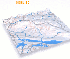 Places with similar names to Oigelito, Mexico ::
// Ojalehto (FI)
Disclaimer :: Information on this page comes without warranty of any kind |
||
|
Where is Oigelito? Elevation and coordinates ::
Latitude (lat): 16°44'0"N Longitude (lon): 92°49'45"W
Elevation (approx.): 1666m (map arrows pan, magnifying glasses zoom) |
||
|
Visiting Oigelito? Hotel/Accommodation ::
Book a hotel in Oigelito Travel Guide ::
Buy a travel guide for Mexico rental cars ::
car rental offers GPS waypoint ::
download a GPX waypoint (PoI) of Oigelito for your GPS receiver
|
||