|
search place name
|
||
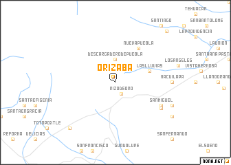
Orizaba (Chiapas, Mexico)Orizaba is a town in the Chiapas region of Mexico. An overview map of the region around Orizaba is displayed below.
regional and 3d topo map of Orizaba, Mexico ::
Orizaba airports ::
The nearest airport is TGZ - Tuxtla Gutierrez Angel Albino Corzo, located 113.2 km east of Orizaba.
Other airports nearby include MTT - Minatitlan (186.9 km north), VSA - Villahermosa C P A Carlos Rovirosa Intl (214.9 km north east), TAP - Tapachula Intl (262.1 km south east), Nearby towns ::
Rizo de Oro (2.1km south east) //
Descargadero de Puebla (3.7km north) //
Las Lluvias (5.6km east) //
Nueva Puebla (6.6km north east) //
San Miguel (8.0km south east) //
La Fábrica (8.2km south east) //
Agua Fría (10.3km south west) //
Las Casitas (11.6km north east) //
[all distances 'as the bird flies' and approximate] 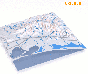 Places with similar names to Orizaba, Mexico ::
// Oruzhba (RU)
// Ouroay Saba (BF)
// Ouro Sabou (BF)
// Orysbay (KZ)
// Oricibo (MX)
// Orizaba (MX)
// Orizaba (MX)
// Orizaba (MX)
// Orizaba (MX)
// Orizaba (MX)
Disclaimer :: Information on this page comes without warranty of any kind |
||
|
Where is Orizaba? Elevation and coordinates ::
Latitude (lat): 16°29'0"N Longitude (lon): 94°5'0"W
Elevation (approx.): 777m (map arrows pan, magnifying glasses zoom) |
||
|
Visiting Orizaba? Hotel/Accommodation ::
Book a hotel in Orizaba Travel Guide ::
Buy a travel guide for Mexico rental cars ::
car rental offers GPS waypoint ::
download a GPX waypoint (PoI) of Orizaba for your GPS receiver
|
||