|
search place name
|
||
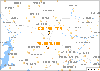
Palos Altos (México, Mexico)Palos Altos is a town in the México region of Mexico. An overview map of the region around Palos Altos is displayed below.
regional and 3d topo map of Palos Altos, Mexico ::
Palos Altos airports ::
The nearest airport is TLC - Toluca Licenciado Adolfo Lopez Mateos Intl, located 78.9 km south of Palos Altos.
Other airports nearby include PCA - Pachuca Ingeniero Juan Guillermo Villasana (81.6 km east), MEX - Mexico City Licenciado Benito Juarez Intl (85.2 km south east), QRO - Queretaro Intercontinental (90.4 km north west), CVJ - Cuernavaca General Mariano Matamoros (138.2 km south), Nearby towns ::
Palo Alto (2.4km south west) //
San Miguel de la Victoria (2.9km north west) //
San José Deguedó (3.7km north) //
La Comunidad (3.9km south) //
Tecoloapan (4.4km north west) //
San Juan Daxhi (5.4km north east) //
Palos Altos (5.6km south) //
El Deni (5.5km north east) //
El Paye (5.7km north) //
Los Encinos (6.1km north east) //
San Miguel de la Victoria (6.3km north west) //
Buenavista (6.7km south) //
Santa Cruz (6.5km east) //
La Vega (6.8km north) //
Calpulalpan (6.7km west) //
Xhitey (7.1km south east) //
Ignacio Zaragoza (6.8km east) //
Santiago Oxthoc (7.5km north) //
La Goleta (7.5km east) //
Vivero (8.0km south east) //
Llano Grande (7.9km south west) //
Agua Escondida (8.2km south) //
El Durazno (8.4km north) //
Los Corrales (7.9km east) //
Las Huertas (8.8km south) //
San Agustín Buenavista (8.3km east) //
Sabino (8.6km south east) //
Las Ánimas (9.0km north west) //
Canalejas (9.5km south west) //
[all distances 'as the bird flies' and approximate] 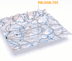 Places with similar names to Palos Altos, Mexico ::
// Palos Altos (MX)
// Palos Altos (MX)
// Palos Altos (MX)
// Palos Altos (MX)
// Palos Altos (MX)
// Palos Altos (MX)
// Palos Altos (MX)
// Palos Altos (MX)
// Palos Altos (MX)
// Palos Altos (MX)
Disclaimer :: Information on this page comes without warranty of any kind |
||
|
Where is Palos Altos? Elevation and coordinates ::
Latitude (lat): 20°3'0"N Longitude (lon): 99°33'45"W
Elevation (approx.): 2492m (map arrows pan, magnifying glasses zoom) |
||
|
Visiting Palos Altos? Hotel/Accommodation ::
Book a hotel in Palos Altos Travel Guide ::
Buy a travel guide for Mexico rental cars ::
car rental offers GPS waypoint ::
download a GPX waypoint (PoI) of Palos Altos for your GPS receiver
|
||