|
search place name
|
||
Pastejé (México, Mexico)Pastejé is a town in the México region of Mexico. An overview map of the region around Pastejé is displayed below.
regional and 3d topo map of Pastejé, Mexico ::

Pastejé airports ::
The nearest airport is TLC - Toluca Licenciado Adolfo Lopez Mateos Intl, located 44.3 km south east of Pastejé.
Other airports nearby include MEX - Mexico City Licenciado Benito Juarez Intl (78.8 km east), CVJ - Cuernavaca General Mariano Matamoros (108.5 km south east), QRO - Queretaro Intercontinental (111.8 km north), PCA - Pachuca Ingeniero Juan Guillermo Villasana (112.8 km north east), Nearby towns ::
Los Reyes (1.8km east) //
Jocotitlán (2.7km north west) //
La Providencia (2.7km north east) //
San Francisco Chejé (2.8km east) //
Huemetla (4.9km north east) //
Boqui (5.2km north east) //
Maboro (5.4km north west) //
Santa María Endaré (6.1km north west) //
San Pedro Los Baños (6.2km west) //
Tlacaque (6.2km east) //
Santo Domingo de Guzman (7.0km south) //
San Francisco (7.3km south) //
Santiago Yeché (7.0km north east) //
San Pablo de los Remedios (7.1km south west) //
Las Ánimas (7.0km west) //
Santa María del Llano (7.6km south east) //
San José del Río (7.9km south) //
Colonia Benito Juárez (7.6km west) //
Colonia Benito Juárez (7.7km west) //
Villejé (7.7km west) //
Siffari (8.4km north west) //
San Francisco El Alto (8.4km south east) //
San Mateo (8.9km south) //
Pueblo Nuevo (9.1km north) //
San Antonio Enchisi (9.4km north west) //
San Antonio (9.5km north west) //
Dolores Amarillas (9.6km south east) //
Zacualpan (9.7km north west) //
San Francisco Chalchihuapan (10.0km north west) //
[all distances 'as the bird flies' and approximate] 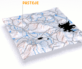 Places with similar names to Pastejé, Mexico ::
Disclaimer :: Information on this page comes without warranty of any kind |
||
|
Where is Pastejé? Elevation and coordinates ::
Latitude (lat): 19°41'2"N Longitude (lon): 99°46'35"W
Elevation (approx.): 2577m (map arrows pan, magnifying glasses zoom) |
||
|
Visiting Pastejé? Hotel/Accommodation ::
Book a hotel in Pastejé Travel Guide ::
Buy a travel guide for Mexico rental cars ::
car rental offers GPS waypoint ::
download a GPX waypoint (PoI) of Pastejé for your GPS receiver
|
||