|
search place name
|
||
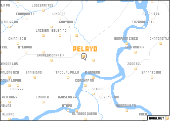
Pelayo (Veracruz-Llave, Mexico)Pelayo is a town in the Veracruz-Llave region of Mexico. An overview map of the region around Pelayo is displayed below.
regional and 3d topo map of Pelayo, Mexico ::
Pelayo airports ::
The nearest airport is MTT - Minatitlan, located 14.2 km north of Pelayo.
Other airports nearby include VSA - Villahermosa C P A Carlos Rovirosa Intl (181.7 km east), VER - Vera Cruz General Heriberto Jara Intl (216.9 km north west), TGZ - Tuxtla Gutierrez Angel Albino Corzo (224.6 km south east), Nearby towns ::
Minatitlán (1.8km east) //
Iguanero (4.1km south east) //
Tacojalpilla (5.1km south west) //
Loma de Indios (5.1km south west) //
Coachapan (5.6km south) //
Mapachapa (5.8km north) //
San Pedro Mártir (7.1km west) //
San Antonio (7.6km south) //
Severino (7.7km north west) //
Sitio Viejo (8.2km south east) //
Guayabal (8.2km north west) //
Casas Nuevas (9.1km north west) //
Encino Gordo (10.2km north west) //
[all distances 'as the bird flies' and approximate] 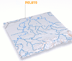 Places with similar names to Pelayo, Mexico ::
Disclaimer :: Information on this page comes without warranty of any kind |
||
|
Where is Pelayo? Elevation and coordinates ::
Latitude (lat): 17°59'0"N Longitude (lon): 94°32'0"W
Elevation (approx.): 33m (map arrows pan, magnifying glasses zoom) |
||
|
Visiting Pelayo? Hotel/Accommodation ::
Book a hotel in Pelayo Travel Guide ::
Buy a travel guide for Mexico rental cars ::
car rental offers GPS waypoint ::
download a GPX waypoint (PoI) of Pelayo for your GPS receiver
|
||