|
search place name
|
||
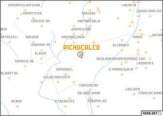
Pichucalco (Chiapas, Mexico)Pichucalco is a town in the Chiapas region of Mexico. An overview map of the region around Pichucalco is displayed below.
regional and 3d topo map of Pichucalco, Mexico ::
Pichucalco airports ::
The nearest airport is VSA - Villahermosa C P A Carlos Rovirosa Intl, located 59.4 km north east of Pichucalco.
Other airports nearby include TGZ - Tuxtla Gutierrez Angel Albino Corzo (105.8 km south), MTT - Minatitlan (173.2 km west), CME - Ciudad Del Carmen Intl (184.0 km north east), Nearby towns ::
Buenos Aires (1.9km north) //
Paso Cosanyapan (4.0km north west) //
San Francisco (4.1km north west) //
El Azufre Segunda Sección (4.6km north east) //
San Miguel (5.1km south west) //
Juan Aldama (5.6km north) //
Santa Anita (5.8km south) //
El Santuario (5.8km north) //
Matamoros Primera Sección (7.0km north west) //
Santa Ana (7.6km north) //
San José (7.6km north) //
Santa Rosalía (7.6km north) //
Concepción (7.6km south) //
Viejo Lindavista (7.7km south west) //
[all distances 'as the bird flies' and approximate] 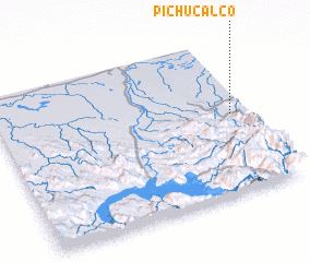 Places with similar names to Pichucalco, Mexico :: Disclaimer :: Information on this page comes without warranty of any kind |
||
|
Where is Pichucalco? Elevation and coordinates ::
Latitude (lat): 17°31'0"N Longitude (lon): 93°4'0"W
Elevation (approx.): 127m (map arrows pan, magnifying glasses zoom) |
||
|
Visiting Pichucalco? Hotel/Accommodation ::
Book a hotel in Pichucalco Travel Guide ::
Buy a travel guide for Mexico rental cars ::
car rental offers GPS waypoint ::
download a GPX waypoint (PoI) of Pichucalco for your GPS receiver
|
||