|
search place name
|
||
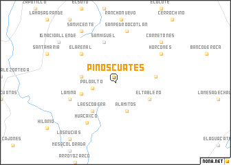
Pinos Cuates (Zacatecas, Mexico)Pinos Cuates is a town in the Zacatecas region of Mexico. An overview map of the region around Pinos Cuates is displayed below.
regional and 3d topo map of Pinos Cuates, Mexico ::
Pinos Cuates airports ::
The nearest airport is GDL - Guadalajara Don Miguel Hidalgo Y Costilla Intl, located 103.7 km south of Pinos Cuates.
Other airports nearby include AGU - Aguascalientes Jesus Teran Intl (107.0 km east), TPQ - Tepic (158.2 km west), ZCL - Zacatecas General Leobardo C Ruiz Intl (172.0 km north), ZMM - Zamora (190.3 km south east), Nearby towns ::
Palo Alto (3.6km west) //
Alamitos (4.9km south) //
Los Cisneros (5.3km west) //
La Cuchilla (5.5km west) //
La Escobera (5.8km south west) //
El Tablero (5.9km south east) //
Las Tablas (6.1km east) //
San Miguel (6.7km north) //
El Arenal (6.9km north west) //
La Mina (7.4km west) //
Huacaxco (7.8km south west) //
San Pedro Ocotlán (8.5km north) //
Horcones (8.3km north east) //
Carretones (9.5km north east) //
San Vicente (9.8km north west) //
[all distances 'as the bird flies' and approximate] 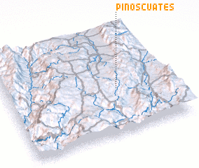 Places with similar names to Pinos Cuates, Mexico ::
// Peñas Chatas (PA)
// Peñas Cuatas (MX)
// Peñas Cuatas (MX)
// Peñasquitos (MX)
// Peñasquitos (MX)
// Pinos Caídos (HN)
Disclaimer :: Information on this page comes without warranty of any kind |
||
|
Where is Pinos Cuates? Elevation and coordinates ::
Latitude (lat): 21°27'30"N Longitude (lon): 103°19'0"W
Elevation (approx.): 2273m (map arrows pan, magnifying glasses zoom) |
||
|
Visiting Pinos Cuates? Hotel/Accommodation ::
Book a hotel in Pinos Cuates Travel Guide ::
Buy a travel guide for Mexico rental cars ::
car rental offers GPS waypoint ::
download a GPX waypoint (PoI) of Pinos Cuates for your GPS receiver
|
||